We need to stay weather aware across North Carolina this afternoon and evening.
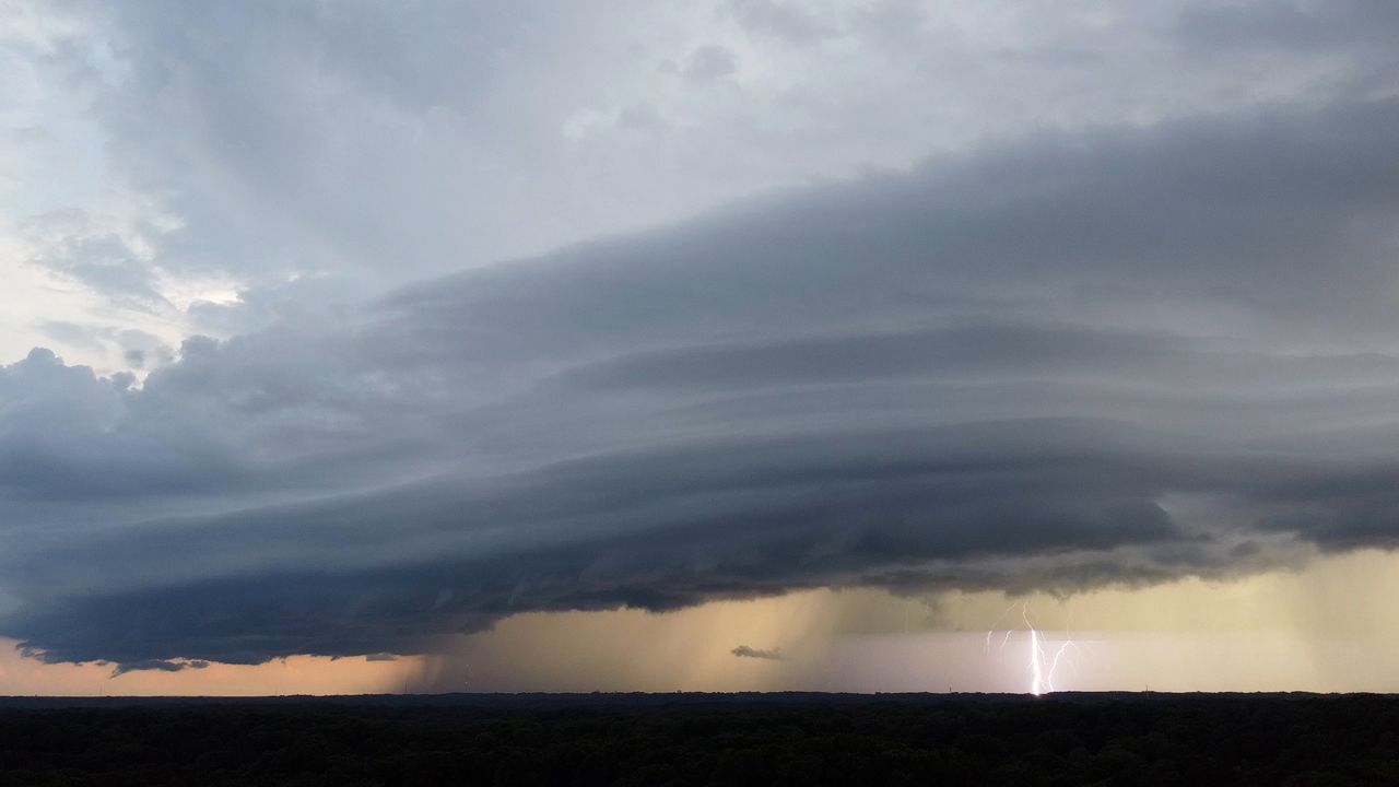
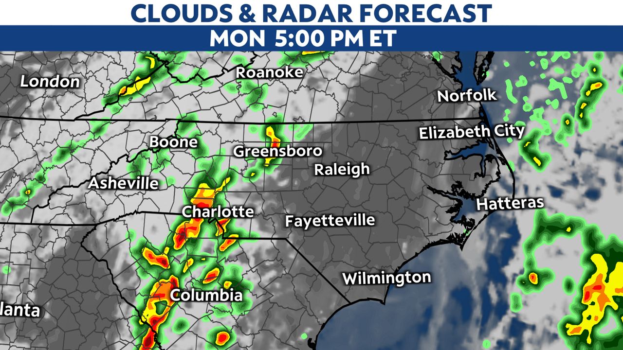
Strong storms are expected to track from west to east across the state from this afternoon into part of the night.
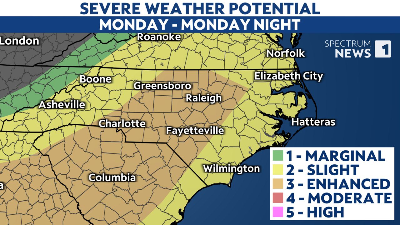
The Storm Prediction Center has placed most of the state under a level 2 to 3 threat for severe storms during that time.
The greatest severe weather threat will be from a few of the storms that could produce damaging straight-line wind gusts in excess of 60 mph.
However, there's also a low risk for a few tornadoes and storms that could produce hail.
The storms could impact the evening commute in parts of the Piedmont, including areas around Charlotte and Greensboro.
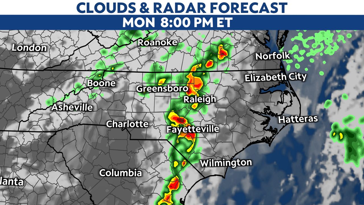
The latest forecast data then shows some of the strongest storms moving through the Triangle and Sandhills a couple hours either side of sunset.
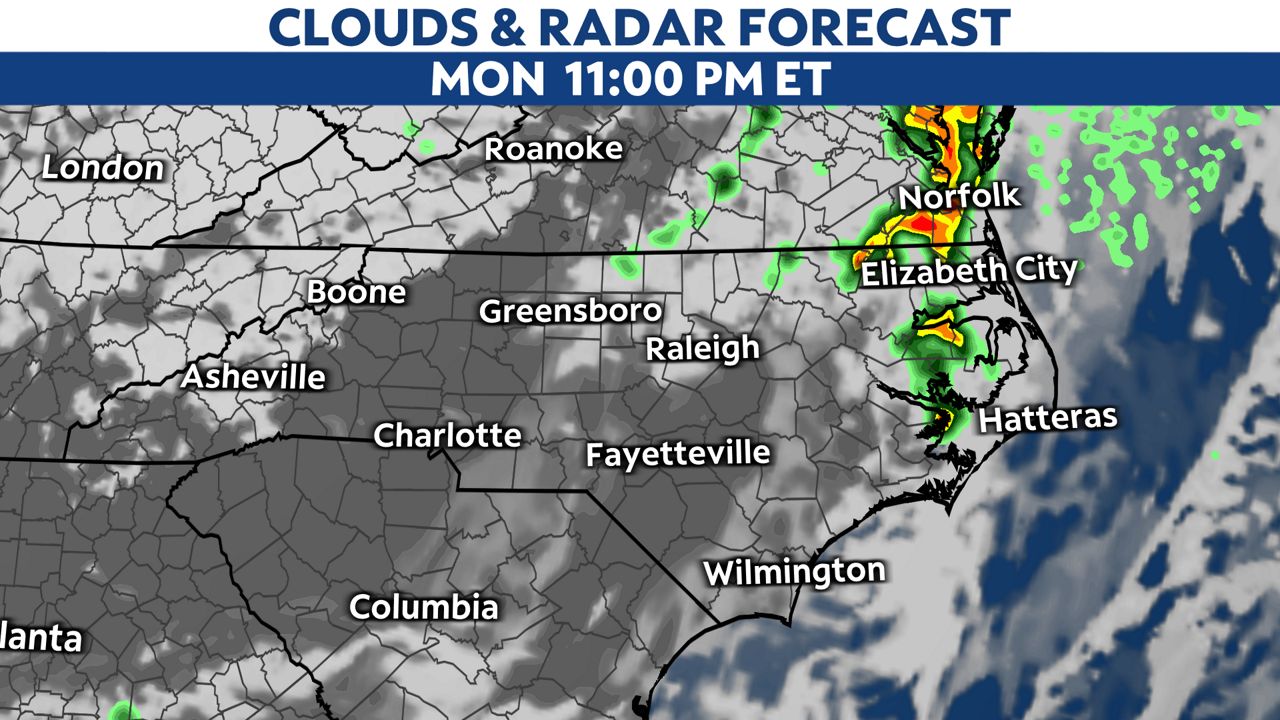
The storms may break up as they move east of I-95 through the evening, but a few may remain strong until they move offshore by around midnight.
Make sure you have a way to receive weather alerts, and have a plan to get to safety if needed.
If a tornado warning is issued, you should immediately seek shelter in a small, interior room on the lowest floor of a sturdy building. Basements, closets, hallways and windowless bathrooms typically provide the best protection.
Stay tuned to Weather on the 1s on Spectrum News 1 and the Spectrum News app for updates.
Our team of meteorologists dives deep into the science of weather and breaks down timely weather data and information. To view more weather and climate stories, check out our weather blogs section.