It's a rare scene Wednesday in eastern North Carolina after a quick hit of snow Tuesday night.
Snow blankets an area from near Charlotte and the Triangle to the coast.
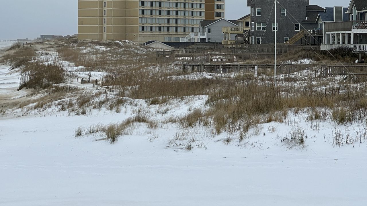
As expected, the highest snowfall reports are from around the coast.
Road crews often have to plow sand off of roads at the Outer Banks, but they are plowing snow today.
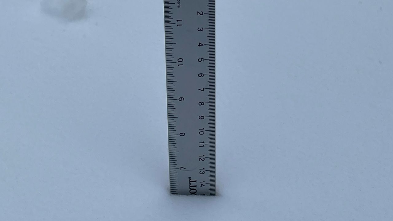
Up to 9 inches has fallen near Kill Devil Hills and one Spectrum News 1 viewer reported 7 inches with drifts up to a foot at Hatteras.
Reports near Morehead City show almost 6 inches. Just 1.5 inches was reported at Raleigh-Durham International Airport and the Charlotte area had less than an inch.
As sunshine returns today, temperatures will climb to near freezing in much of the state. That will allow for some melting on surfaces like asphalt and rooftops that are in the direct sunlight. That melting will be limited where there are several inches of snow on the ground.
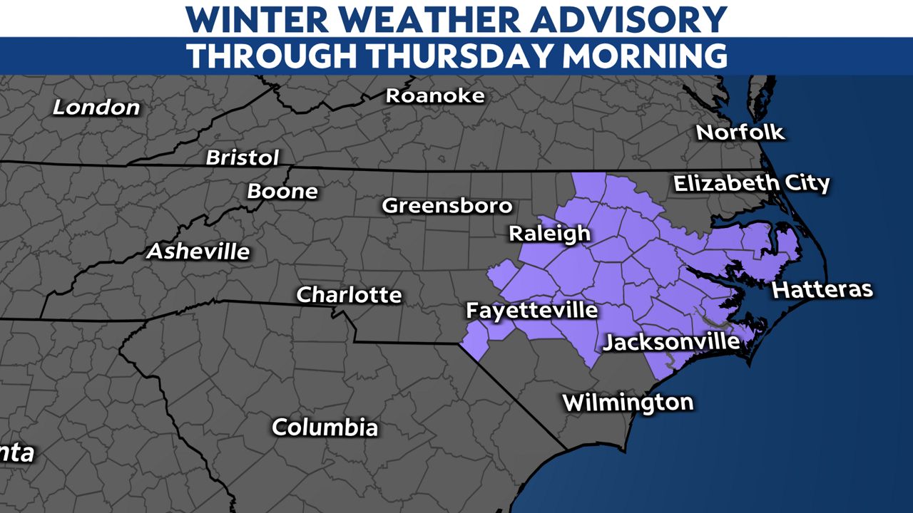
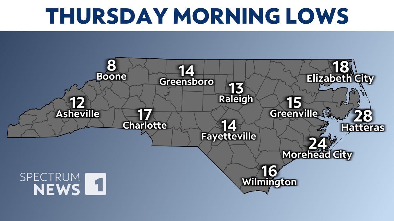
A Winter Weather Advisory has been issued for parts of central and eastern North Carolina where black ice may impact travel Thursday morning. Everything that melts will freeze over tonight with lows dropping to the teens in most of the state.
Icy roads will continue to be an issue in many communities that saw the snow through Thursday.
Stay tuned to Spectrum News 1 for updates.
Our team of meteorologists dives deep into the science of weather and breaks down timely weather data and information. To view more weather and climate stories, check out our weather blogs section.