


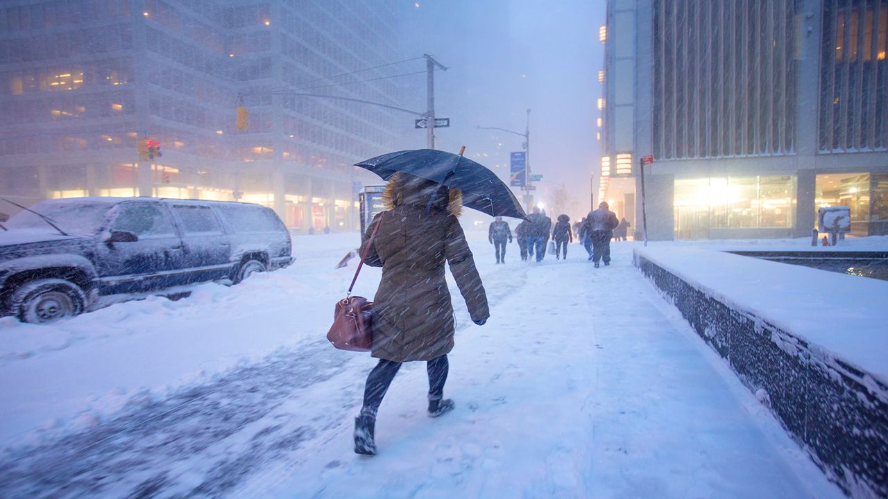
Last year, New York City set records for the least amount of snow. This winter could be very different.
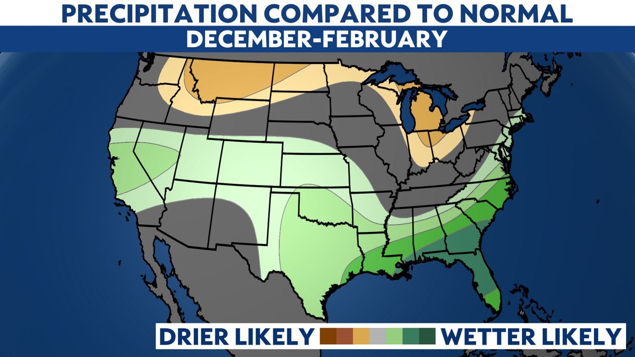
The National Oceanic and Atmospheric Administration (NOAA) released its winter weather outlook on Oct. 19. Forecasters at NOAA say that El Niño, which is a cyclical weather pattern when the water off South America in the Pacific Ocean is warmer than average, has returned after three consecutive years of La Niña conditions. That is when the water in the same area is cooler than average.
These patterns impact weather across the globe and can affect everything from hurricanes to winter storms to drought.
For the nation, warmer than average temperatures are forecast for much of the northern third of the country.
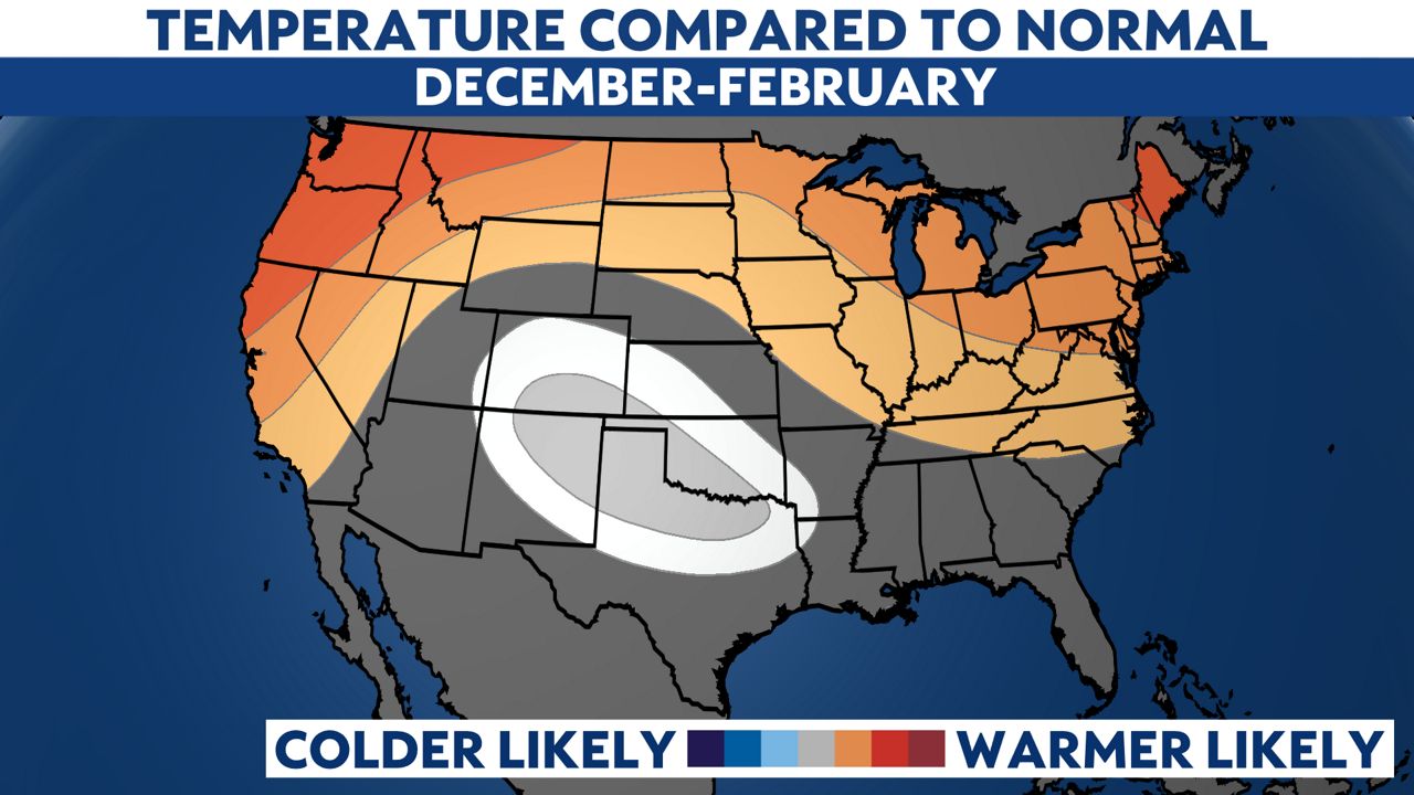
So what kind of winter will we see in New York City? These long-range predictions are still an evolving science, but the NOAA outlook calls for New York City to see a generally wet and mild winter. That's not great news for snow lovers who barely saw a flake last year. The winter of 2022-23 brought Central Park less than 3 inches of snow. That's barely enough for even a snowball! It was the least snowy winter in over 150 years for us here in the city.
Is there any hope for snow this winter? There is!
El Niño and La Niña episodes vary by strength. To estimate what this winter will bring, forecasters look at the intensity of past El Niños and look to see what the winter was like then. This year's El Niño's strength most closely matches the winter of 2009-2010. That winter had three major storms and total snowfall was over 50 inches.
The El Niño weather pattern typically has a strong southern jet stream. This feature can help to make frequent coastal storms or what we call nor'easters. The tricky part is syncing up the storms with cold air.
Summing it up, expect to see a rainy winter in the city, but there will be likely one to three shots at a major snowfall. And when winter storms happen this year, their impacts will be described by the Winter Storm Severity Index, which will move out of its experimental phase this winter.
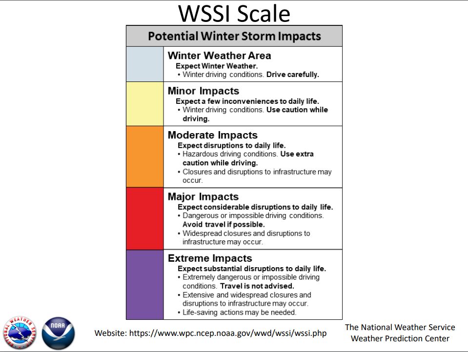
This scale has been used by NOAA the past few winters in an unofficial testing capacity, but this year it will become official. Expect to hear government leaders and media use the Winter Storm Severity Index (WSSI).
The scale has four impact categories: minor, moderate, major and extreme. The categories take into account the strength of the storm and also the location. So a 10-inch snowstorm that impacts us here in New York City is going to rate higher on the impact scale than a 10-inch snow event in Albany, because our population is so much greater.
So, overall, the NOAA winter outlook is not encouraging for snow lovers, but one big storm could cause a lot of trouble.
Our team of meteorologists dives deep into the science of weather and breaks down timely weather data and information. To view more weather and climate stories, check out our weather blogs section.