


The start of the year was a warm and wet one, with temperatures and precipitation above average.
Also notable was our first snowfall of more than an inch since Feb. 2022.
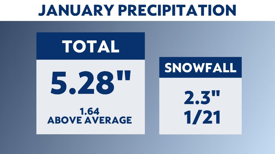
On Jan. 21, Central Park recorded 2.3 inches of snow. It wasn’t a lot of snow, but it ended the longest streak of not seeing a one-inch snowfall in over 600 days. January is typically the second snowiest month of the year.
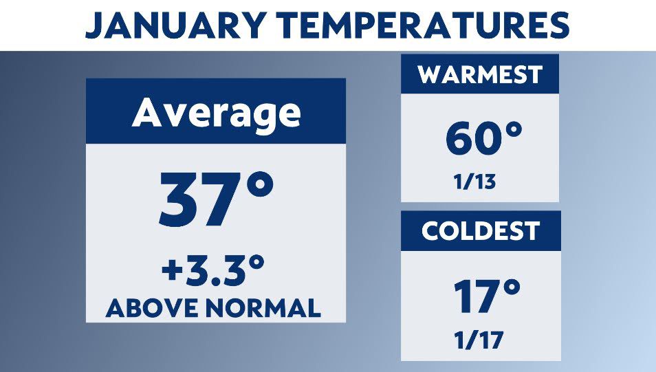
The year got off to a warm start. Readings for January averaged more than three degrees above normal.
But we had a short frigid blast. Temperatures dropped to 17 degrees on the 17th. This deep freeze came just a few days after we had a spring preview.
On the 13th, readings reached 60 degrees.
This January did not rank in the top 10 warmest on record.
January is one of the drier months. It ranks as the third driest for NYC.
But for this January, we were wet. Precipitation totaled over five inches. That’s for rain and snow combined. Overall, the precipitation was just over two inches more than the average for January.
The warm and wet winter conditions aren’t a surprise to most meteorologists. This winter, there is a super El Niño in effect. This weather pattern typically means warm and wet conditions for New York City.
Our team of meteorologists dives deep into the science of weather and breaks down timely weather data and information. To view more weather and climate stories, check out our weather blogs section.


