Soaking rain and strong winds are in store tonight. Behind the storm is a snow threat next week and a cold change.
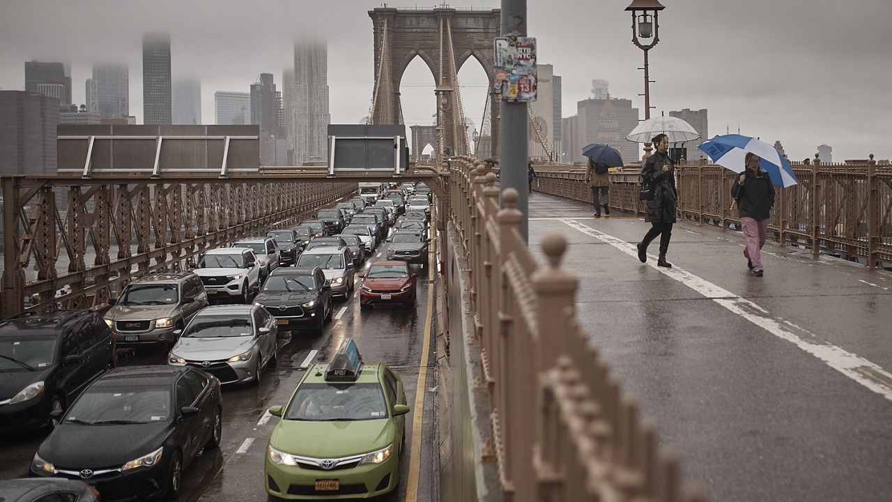
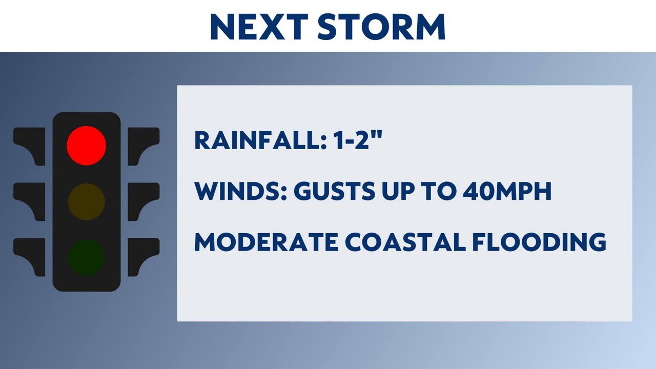
The first of what could be two storms in six days is on the way. This one will bring heavy rain, gusty winds and a coastal flood threat. Here are the details.
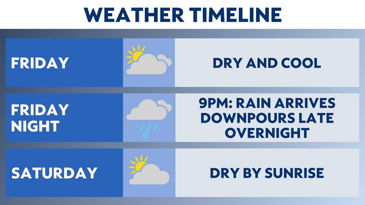
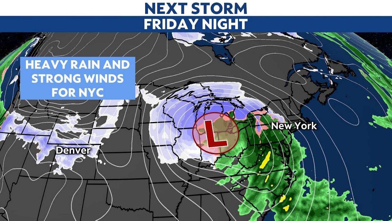
Heavy rain and strong winds are expected to be back in the city late Friday night. A storm system will move through the region. The rain and wind do not look as intense as the last system.
Rainfall of 1 to 2 inches is likely, with most of it falling between 10 p.m. on Friday and 3 a.m. on Saturday. Scattered highway flooding is possible. For the winds, gusts could reach 40 mph.
Some isolated wind issues are possible, but widespread downed trees or power problems are unlikely.
This storm could also bring moderate coastal concerns on Saturday morning.
Coastal residents should make sure their cars are not parked in low-lying areas on Friday night and Saturday morning.
The rain and wind are also expected to be cleared out by sunrise on Saturday, and the rest of the holiday weekend will be dry.
Looking at our Friday morning weather models, the chance for a snow event on Tuesday is lower. The latest weather models show the storm staying out to sea. It's still early, so the trend for snow could return, but as of now, snow lovers should not get their hopes up. Here's more on the possible event.
Our next storm system is possible on Tuesday. This one is less of a sure bet. Weather models vary in their forecasts. The potential impacts at this point range from nothing to light rain and snow to a light to moderate snowfall.
It’s just too soon to tell where the storm will track. The storm scenario is an area of low pressure that is tracking off the coast of Virginia and then east of Long Island.
This is a favorable storm track for snow chances, but a track too far out to sea will leave us dry. A storm too close to the coast would bring us mainly rain. We’ll have to observe this system, as it could affect the morning commute to work or school on Tuesday.
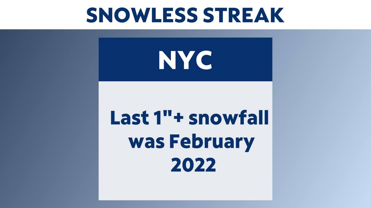
Sunday will mark the 700th consecutive day without 1 inch or greater snowfall for New York City. This is the longest we’ve gone without a snowstorm in more than 150 years.
Last year, we saw just 2.2 inches for the entire winter. An average winter brings us around 30 inches of snow. What's fueling our snowless streak? It's warm winter temperatures.
Last year was the hottest for New York City in the past 154 years. We had a very warm January and December. February was the third warmest on record. It’s tough to get snow when temperatures are setting records.
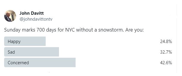
This lack of snow has some people happy, while others are disappointed or concerned. Look at the results from our Twitter poll about the lack of snow in New York City:
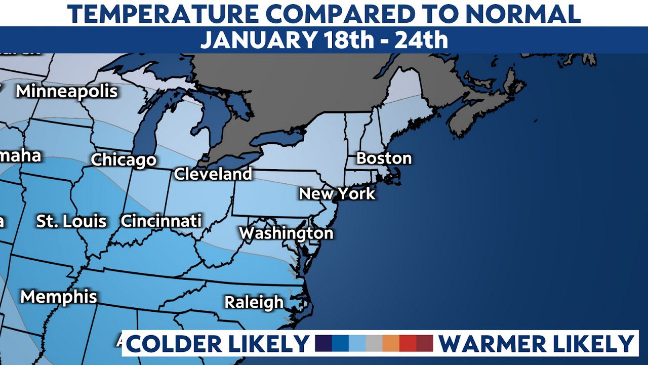
A big change in our temperatures is on the way. The jet stream shifts early next week, and it looks like we’ll have much colder weather for most of the rest of the month.
The latest outlook from the National Weather Service is calling for below average temperatures from Jan. 18 to Jan. 24. We could see low temperatures in the teens and 20s and high temperatures only in the 30s.
Our team of meteorologists dives deep into the science of weather and breaks down timely weather data and information. To view more weather and climate stories, check out our weather blogs section.