


After a week of multiple rounds of severe storms and heavy rain, a much more stable pattern will arrive in time for the weekend.
Strong and severe storms will shift to south Texas by Saturday morning, and much drier and cooler air will move in for the next few days.
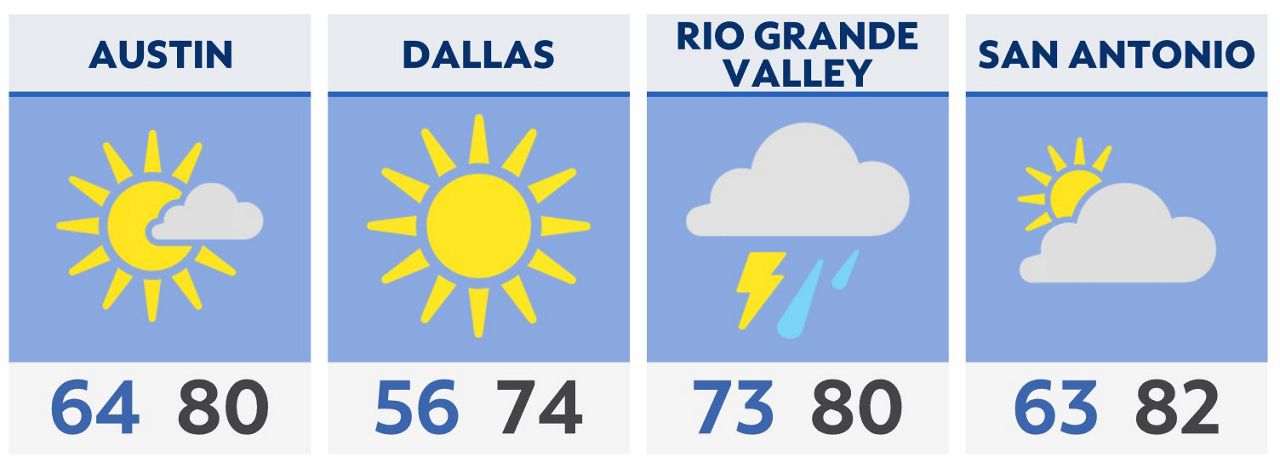
We’ll see clearing skies for most by Saturday morning. That much drier air will also offer some very pleasant temperatures; morning lows in the 50s and afternoon highs in the 70s and 80s.
The front will be pushing through the Lower Rio Grande Valley Saturday morning with severe storms and heavy rain a possibility. Large hail, damaging winds, and an isolated tornado are possible in that area.
By Sunday morning, most of Texas will enjoy a well-earned break in the stormy pattern.
That enjoyable weather will be brief, however. The upper-level pattern returns to one that will produce several rounds of severe weather and heavy rain for next week.
Click here for the latest 7 Day Forecast | Click here to share your weather photos