August means hot days and possible heat waves in NYC. This year, the heat was on hold.
What You Need To Know
- There were no 90-degree days this August
- It rained 12 out of 31 days
- Temperatures averaged more than one degree below average
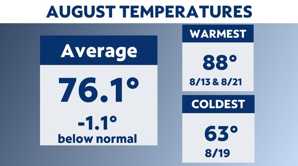
This August was on the mild side. Temperatures averaged 1.1 degrees below average, and most notable of all, there were no 90-degree days.
This was the first time since 1984 that NYC didn't record at least one 90-degree day. This lack of heat followed the trend we saw for much of the summer.
During June, July and August, we only had six days of 90-degree or more heat. A normal NYC summer has 15 days of 90+, and last summer, we had 24 days where temperatures reached 90 degrees or more.
Also, we didn't have any heat waves in June, July or August. A heat wave for New York City is three consecutive days of 90 degrees or higher.
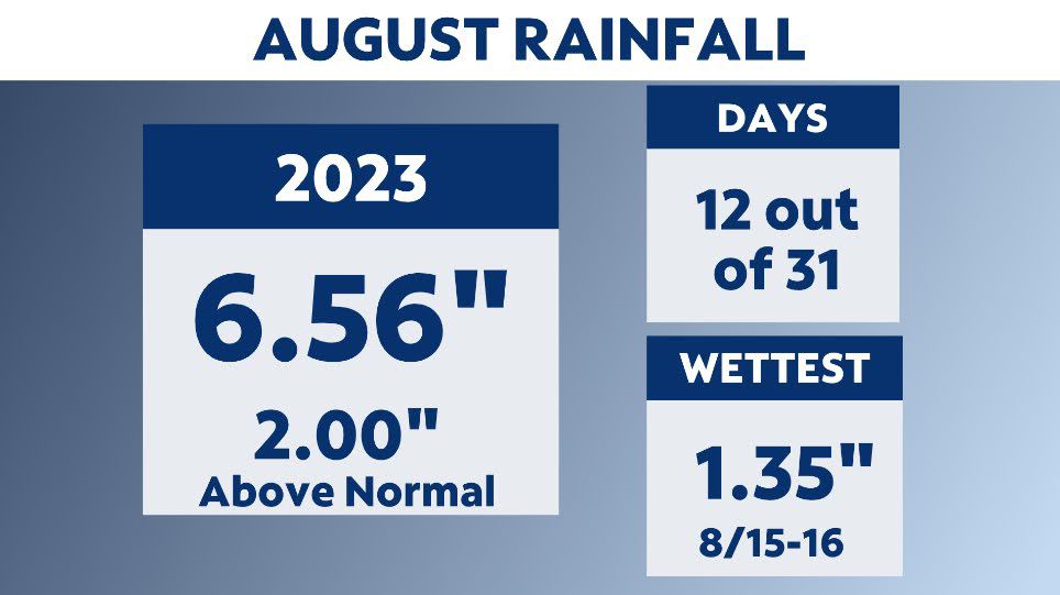
Rainfall for August was above average. We received just over six inches of rain. That's two inches more than the average. Overall, we had measurable rainfall on 12 out of the 31 days.
The wettest period was Aug. 15 and 16, when over an inch of rain fell.
August is typically one of the top four wettest months of the year for New York City.
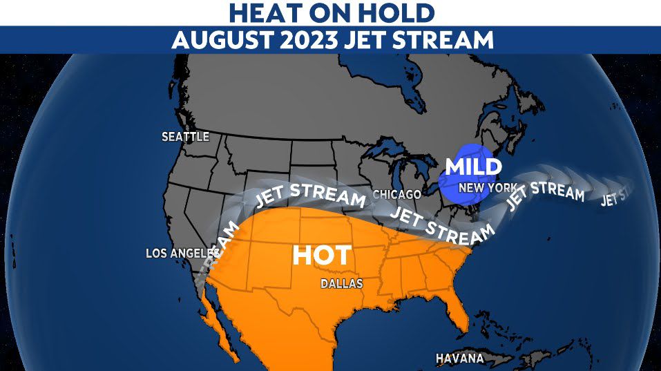
The lack of heat in New York City was in stark contrast to much of the United States.
Heat domes over much of the south and southwest prompted heat alerts for millions. Heat domes are stuck jet stream patterns that trap heat and can last for weeks.
The jet stream pattern for New York City was a trough. These are dips in the jet stream. They often mean mild and wet weather patterns, like we saw this past August.
Our team of meteorologists dives deep into the science of weather and breaks down timely weather data and information. To view more weather and climate stories, check out our weather blogs section.