The Omega block weather pattern may be all Greek to some, but it is actually one of the more popular blocking patterns that meteorologist refer to nowadays.
This pattern sets in when two cutoff lows are intersected by a large area of high pressure in between. This forces the jet stream to curve around each of the low pressure troughs while arcing over the large high pressure ridge.
Since the jet stream takes on the shape of the Greek letter omega (Ω), it earned the name “Omega” block pattern.
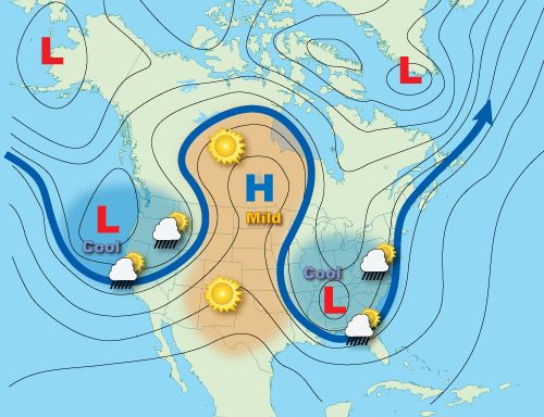
Areas situated under the high pressure ridge will typically face a stretch of sunny and dry days, along with above-average temperatures. However, cooler and wetter conditions will dominate for places sitting under either of the two troughs of low pressure.
Depending on the location and duration, Omega block patterns could prove detrimental to some places.
Those living under the ridge of high pressure could face worsening drought conditions and days of scorching temperatures brought on by a stubborn heat dome.
Cooler and wetter conditions will dominate under the areas of low pressure. With days of rain and showers in the forecast, these areas could combat rising water levels and flooding impacts.
Drought and flooding aren’t the only impacts that come with an Omega block pattern, either.
As wildfires raged out of control across Quebec, Canada in early June 2023, an Omega block locked in over the U.S.
While that alone isn’t at all jarring, the precise positioning of the block brought a profound and historic outcome across parts of the Midwest and Northeast.
High pressure stretched through the Plains, with one area of low pressure hovering over southern California and the other centered over Maine and the Canadian Maritimes.
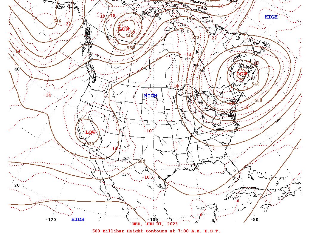
Clockwise rotation of the high along with the counterclockwise rotation of the low spinning nearest New England managed to steer heavy ground-level smoke in across Lake Erie and Lake Ontario, bringing hazardous air quality levels to the most densely populated parts of the country.
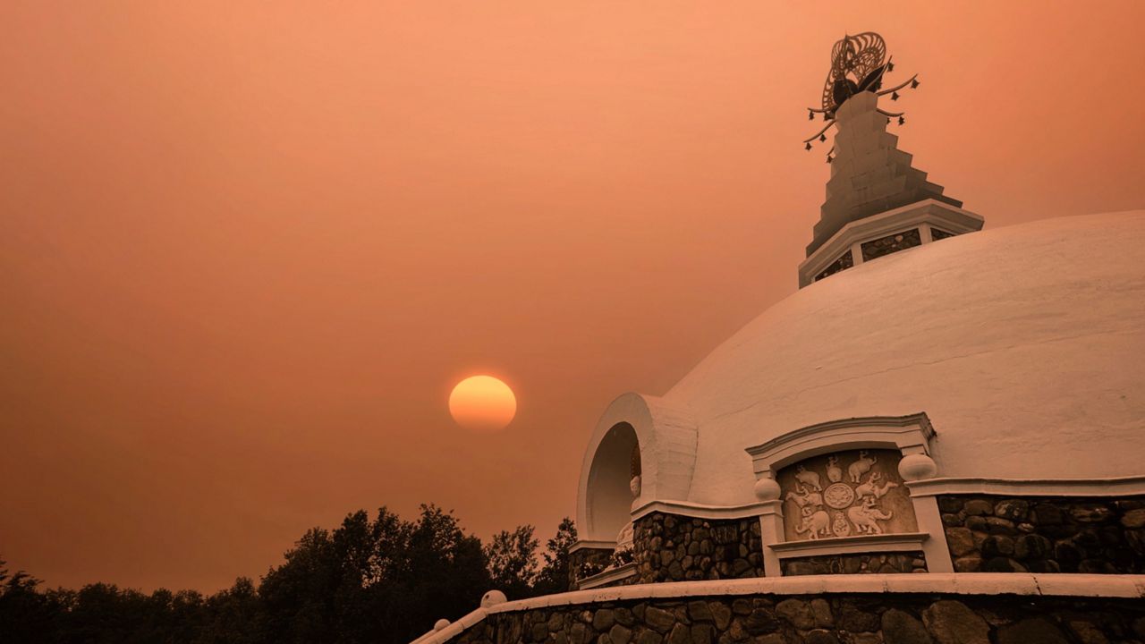
A plume of thick smoke traveled across Upstate New York and took direct aim at New York City, where it cast an unforgettable amber haze throughout the Big Apple.
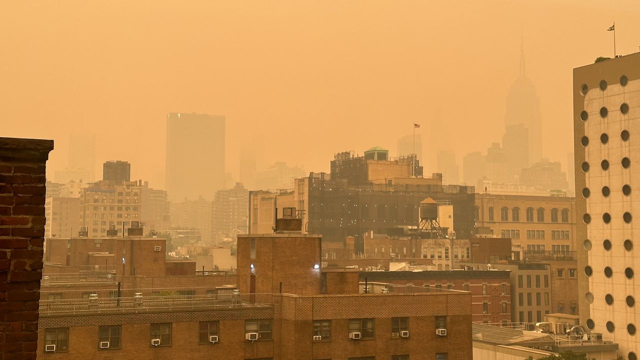
Other cities across the Mid-Atlantic reported their worst air quality levels on record, but New York City observed the worst air quality during that day.
While this certainly isn’t a typical impact, it goes to show that Omega block patterns can still have other consequences that extend beyond the standard hot and dry versus cool and wet conditions they come with.
Our team of meteorologists dives deep into the science of weather and breaks down timely weather data and information. To view more weather and climate stories, check out our weather blogs section.


