A wild cold front dropped temperatures by more than 60 degrees across parts of the High Plains and Rockies this week, and some spots saw more than a foot of snow - all of this taking place on or just after Labor Day.
By early September, the first fronts of the fall season will usually start moving into the northern tier of the country, dropping temperatures from short-sleeve to sweatshirt levels as they do so.
But it’s not necessarily common for temperatures to fall from swimsuit to winter coat levels, let alone in just a few hours this early in the autumn season (or late summer if you're into astronomy).
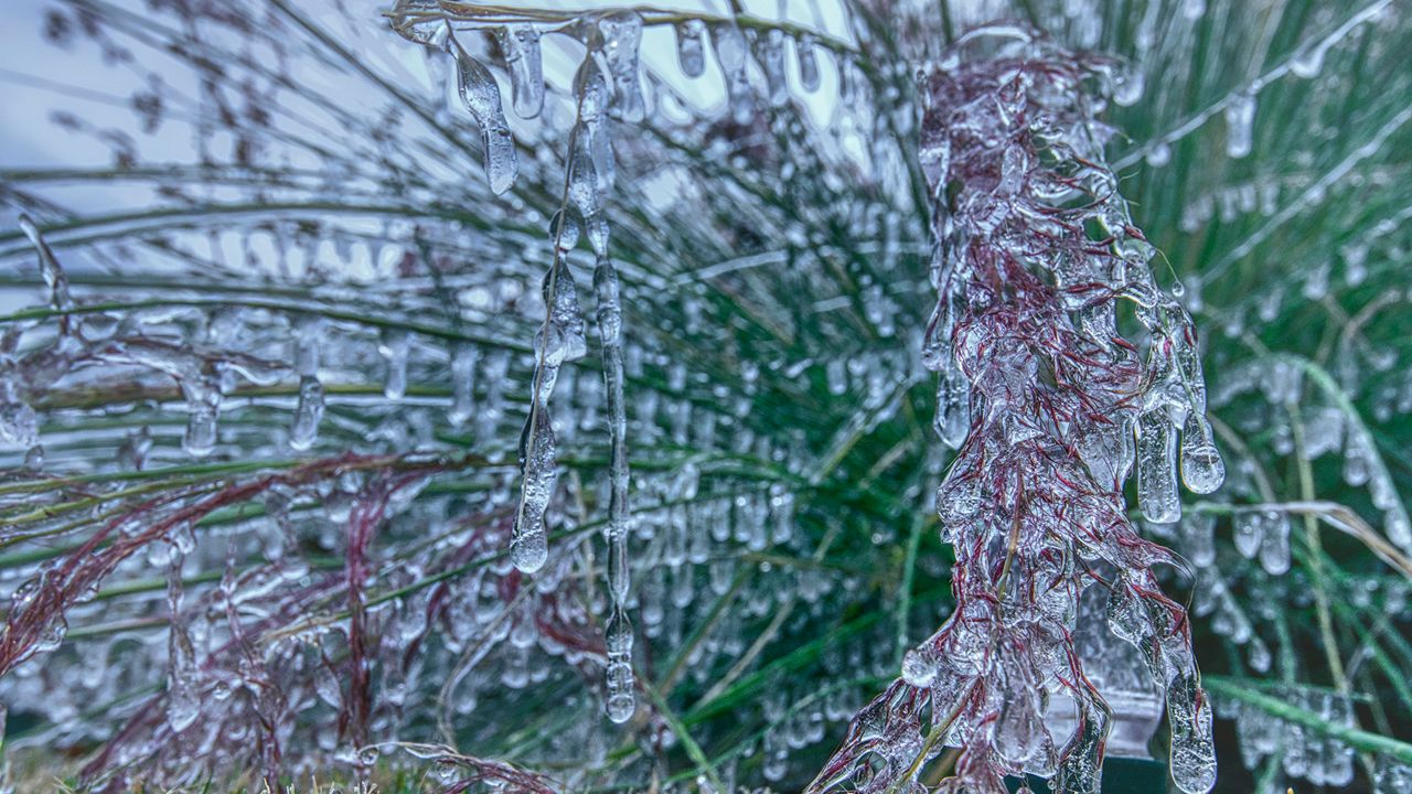
Heavy snow piled up in parts of Montana, South Dakota, Wyoming and Colorado on Monday and Tuesday, all thanks to an exceptionally powerful cold front that dropped temperatures by more than 60 degrees in just a few hours.
Places like Casper, Wyoming and Rapid City, South Dakota saw several inches of wet, heavy snow - and in both cases, mere hours after temperatures had spiked to at or near 100 degrees.
That's right. Snow fell on areas that had been near the century mark a day or two prior.
The snow weighed down trees and power lines. Early season snows tend to have a higher water content to them, adding extra weight than typical mid-winter snow events.
All-in-all, it’s looking like a winter-like forecast for the final few days of astronomical summer.
Picture this: residents in Denver were enjoying a wonderful Labor Day weekend by the pool, with temperatures rocketing up to 101 degrees on Saturday and 97 degrees on Sunday.
By Tuesday, it was snowing there, and Denver also tied its earliest freeze on record on Tuesday.
Denver’s average first measurable snowfall isn’t until mid-October, though it has snowed as early as September 3rd there. An official measurable snowfall on September 8th or 9th, though, would be exceptionally early.
While wild temperature swings are fairly common in Denver, this week’s temperature rollercoaster ride could truly be in a league of its own.
So what’s behind this wild early September weather, other than this being 2020? Twin typhoons in the Pacific Ocean are liekly creating a meteorological domino effect that’s driving cold air from northern Canada down to the central United States.
The exceptionally low-pressure values created by Typhoons Maysak and Haishen are helping create a ripple effect on the jet stream, helping pull down cold air from near the Arctic and down deep into the lower 48.
This same cold front will eventually reach the Gulf Coast and other parts of the Midwest, dropping temperatures there as well. The snow and wildest temperature swings, however, should be mainly confined to the higher elevations of the Rockies.
However, the Great Lakes states, the Midwest, and even places as far south as Texas and Louisiana could feel chillier-than-average temperatures by the middle of the week.
So while the calendar might say it’s still early September, Mother Nature will make it feel more like November or even December for parts of the country this week.