In coastal neighborhoods of New York City, where storm surges are expected and the memory of Superstorm Sandy still fresh, thousands of homeowners have flood insurance.
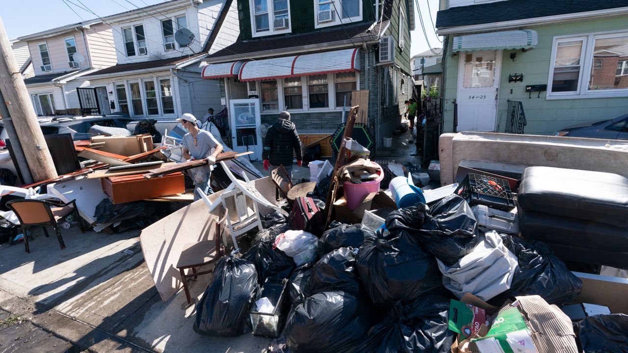
In central and northern Queens, where flash floods last week caused by the remnants of Hurricane Ida led to at least 13 deaths and ruined entire blocks of homes, some ZIP codes have just a couple dozen policies.
The level of destruction wrought by Ida has forced the city to confront the danger of water in its midst, forced onto the street by an outdated sewer system, and not just at its shoreline edges — and will almost certainly push families most impacted by the storm to seek out flood insurance policies, experts say.
Already, 1,661 households have visited service centers, according to the Office of Emergency Management.
Those residents would be buying policies at a turning point for the National Flood Insurance Program, administered by the Federal Emergency Management Agency: On Oct. 1, FEMA is instituting sweeping changes to its risk rating system, which it says will either reduce or only modestly increase premium costs for nearly all policyholders, instead of raising costs across the board.
The new system comes as more and more Americans, and New Yorkers in particular, are realizing their exposure to flood risk. It will price homes based on a wider range of variables than its decades-old methodology, in an attempt to reduce the number of people under- and over-paying for policies as well as close a billions-wide gap between premiums collected and payouts distributed.
Without such policies, city residents are at the mercy of federal disaster relief, which, unlike flood insurance, requires presidential approval and does not aim to make a homeowner whole after a flood, according to Laura Lightbody, director of the Pew Charitable Trusts’ flood-prepared communities initiative.
“I could tell you right now, more people need to get flood insurance,” Lightbody said. “It is the first line of defense, the first form of mitigation that a homeowner or a renter can do in terms of reducing their fiscal exposure to flooding.”
Yet insurance experts and city officials say that, although updates to the system are necessary, they are concerned that the new risk rating system is too opaque, and will result in steep cost increases for low-income homeowners, especially those who live in areas most prone to coastal flooding.
“The inequity that it creates is certainly a tough one,” said Upmanu Lall, a professor of engineering at Columbia University, who studies flood management and risk. “Invariably the people who end up being exposed are low-income people.”
The Bronx will see most premiums reduced
Changes to FEMA’s premium pricing system — called Risk Rating 2.0 — go into effect Oct. 1 for new policies, and in April 2022 for existing policies. FEMA says that its methodology includes new variables the old system did not, such as flood frequency, flood type, risk from tsunamis and heavy rainfall, such as the kind seen during Ida, as well as property characteristics like elevation and cost to rebuild.
The subtitle of the new system is “Equity in Action,” which points to FEMA’s contention that it will distribute insurance costs fairly. For some neighborhoods with the largest number of policies, the immediate savings will be widespread, according to analyses of FEMA data by Pew and shared with NY1.
In the Bronx, where flooding threatens southern neighborhoods like Throgs Neck and Mott Haven, 54% of policies will see premiums reduced; in Brooklyn, 32% of premiums will see decreases, and about half of policies will increase by no more than $120 per year.
In those boroughs, the majority of policy increases will be less than $120 per year. On average, FEMA says, policy holders have seen annual premium increases of $96 per year under the old risk rating system.
Some areas will see even steeper savings, reflecting a major cost correction. In Throgs Neck, which has 1,418 policies, as well as Red Hook in Brooklyn and Alphabet City in Manhattan, about a quarter of policyholders will see premiums decrease by at least $1,200 each year, according to FEMA data. Midland Beach, on Staten Island, will see a fifth of its premiums decline by that amount.
In East Harlem below 116th Street, which faces increasing flood risk due to low elevation and little coastal flood mitigation, 37% of the area’s 612 policyholders will pay at least $1,200 less each year.
A few areas with relatively fewer policies will see steep increases: In Park Slope, about half of its 175 policyholders will have to pay up to $10 more per month, while 3% will pay at least $100 a month more.
“The old system essentially had a bias against lower value homes,” Lightbody said. “Those are likely the ones who have been overpaying.”
Yet city officials have repeatedly criticized the new risk ratings, pointing to the 18% annual increase in premiums — up to a predetermined cap — allowed by federal law, and objecting to FEMA’s refusal to publicly share its methodology for calculating rates or share address-level data with the city.
The opacity, according to Jainey Bavishi, director of the Mayor’s Office of Climate Resiliency, means that homeowners don’t know what specific changes they or their communities can make to improve their risk ratings.
“We remain extremely concerned that FEMA’s Risk Rating 2.0 policy will trigger higher premiums that will put flood insurance out of reach for vulnerable low-income families,” Bavishi said in an emailed statement.
In an emailed statement, Don Caetano, a FEMA spokesperson, said that the agency has “worked closely with the City, responding to inquiries related to Risk Rating 2.0, and routinely provides the City with NFIP data to better inform their resident outreach and other initiatives.”
‘You guys are at risk’
What has been missing from the push to update the risk ratings, homeowner advocates say, is clarity about costs, especially for people who do not face coastal flooding risk — a category that includes residents of neighborhoods hit hardest by the Ida floods.
FEMA is eliminating what it called its Preferred Risk policy, which used a separate methodology for calculating premiums meant for structures outside of the coastal floodplain. Typical homeowner’s insurance does not cover flooding damage, Lightbody said. That leaves costs for those homeowners unclear, according to Aaron Sturm, a program manager with the Center for New York City Neighborhoods.
“I’m sure Ida will motivate some folks to explore flood insurance,” he said. “But that's not an easy option, especially if you're paycheck to paycheck and we're still in a pandemic.”
Federal law requires homeowners in FEMA’s floodplain — defined as the area that would be flooded during a storm of once-every-century intensity, calculated based on recent weather data — to purchase flood insurance. But experts say that the maps should not be taken as a guide to who should buy flood insurance.
Lall said that several neighbors of his in Central Harlem saw their basements flooded with several feet of water during Ida.
“According to the maps, we have absolutely no risk,” he said. “But here we are.”
What should fill the gap, Lightbody said, is better incentive programs from the city to encourage homeowners to get flood insurance, such as by subsidizing premiums, as well as continuing efforts to overhaul the sewer system.
The new risk rating will also point to perhaps the most controversial flood risk mitigation tool: moving families, and entire communities, out of flood-prone areas. Low-value homes that see high increases in premiums will be indicators of where to begin those efforts, Lall said.
“It’s a big signal,” he said. “It says, ‘You guys are at risk. You need to start thinking about what you need to do.’”
FEMA is currently working on an update to its floodplain maps, which will increase the number of households legally required to hold flood insurance, and likely expand areas of focus for so-called managed retreat efforts.
Already, about 7%, or just over 11,000, of New York State’s NFIP policies will see the highest premium increases — at least $240 more per year — one of the largest proportions of any state.
“There are 11,000 houses that probably need to be relocated, and those people need to be moved,” Lall said.


