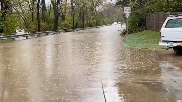
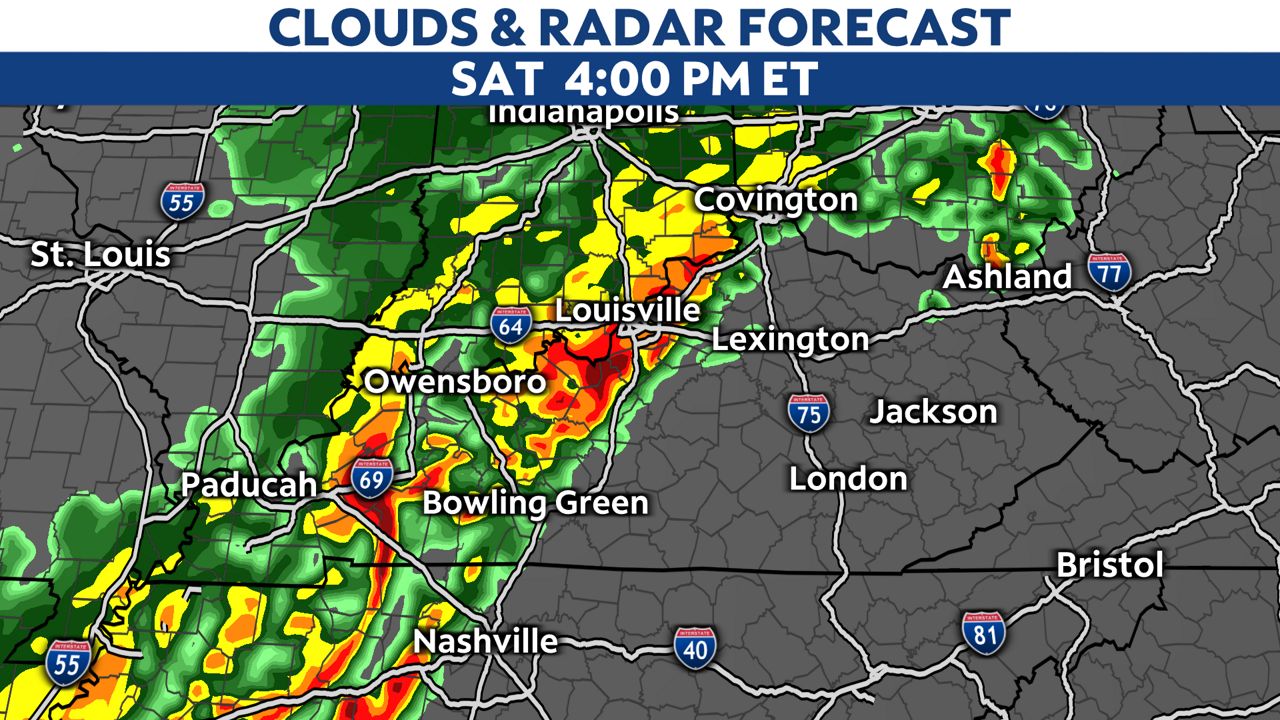
The stalled frontal boundary combined with plenty of moisture will bring more storms and plenty of heavy rainfall to the area today
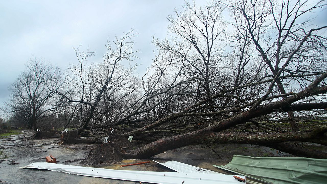
The Storm Prediction Center (SPC) has mainly areas across central Kentucky in the area for a few severe storms, but the best chance will southeast of a line from Bowling Green to Lexington this afternoon. Damaging winds and a few spin up tornadoes will be possible.
)
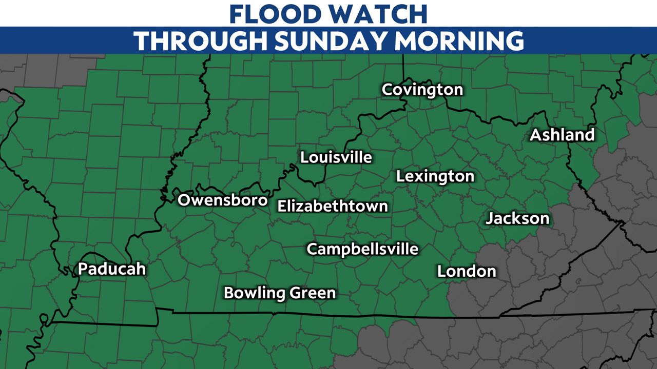
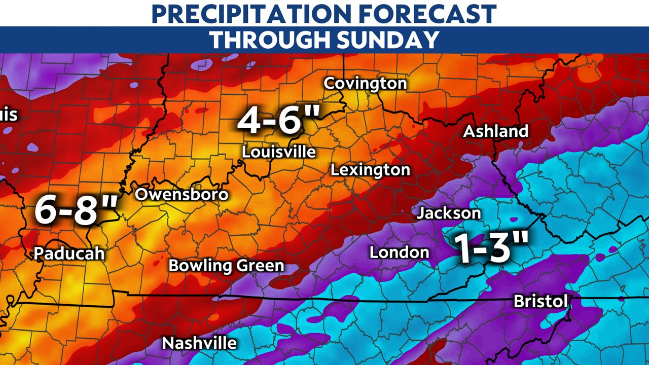
With the stalled frontal boundary staying parked over our area through the weekend, the flooding threat is very high. We are under a Flood Watch through the weekend. There is strong wording from the National Weather Service in the watch, stating this is expected to be a "high-end event with life-threatening flooding."
Waves of rain and storms will continue through Sunday morning. A few strong to severe storms will be possible, especially in southeast Kentucky. Heavy rainfall sticks around most of Saturday with lingering showers on Sunday.
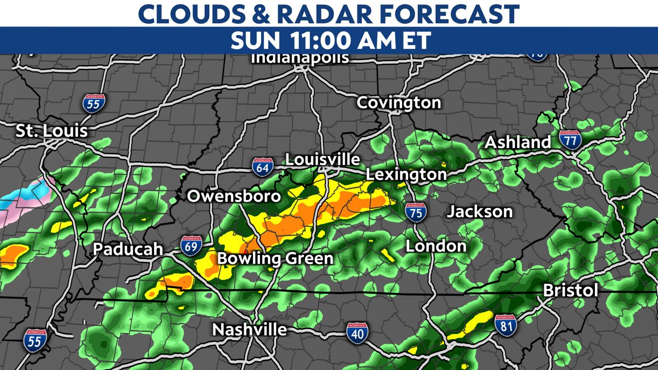
Additional rainfall expected is between 4 to 8 inches through Sunday. Expect lighter amounts in eastern Kentucky.
Our team of meteorologists dives deep into the science of weather and breaks down timely weather data and information. To view more weather and climate stories, check out our weather blogs section.