


OHIO — After a warm, windy and summery day on Friday, storms will move in as the weekend gets underway.
Ahead of a cold front, a few isolated showers and storms will push into far northwestern Ohio after midnight.
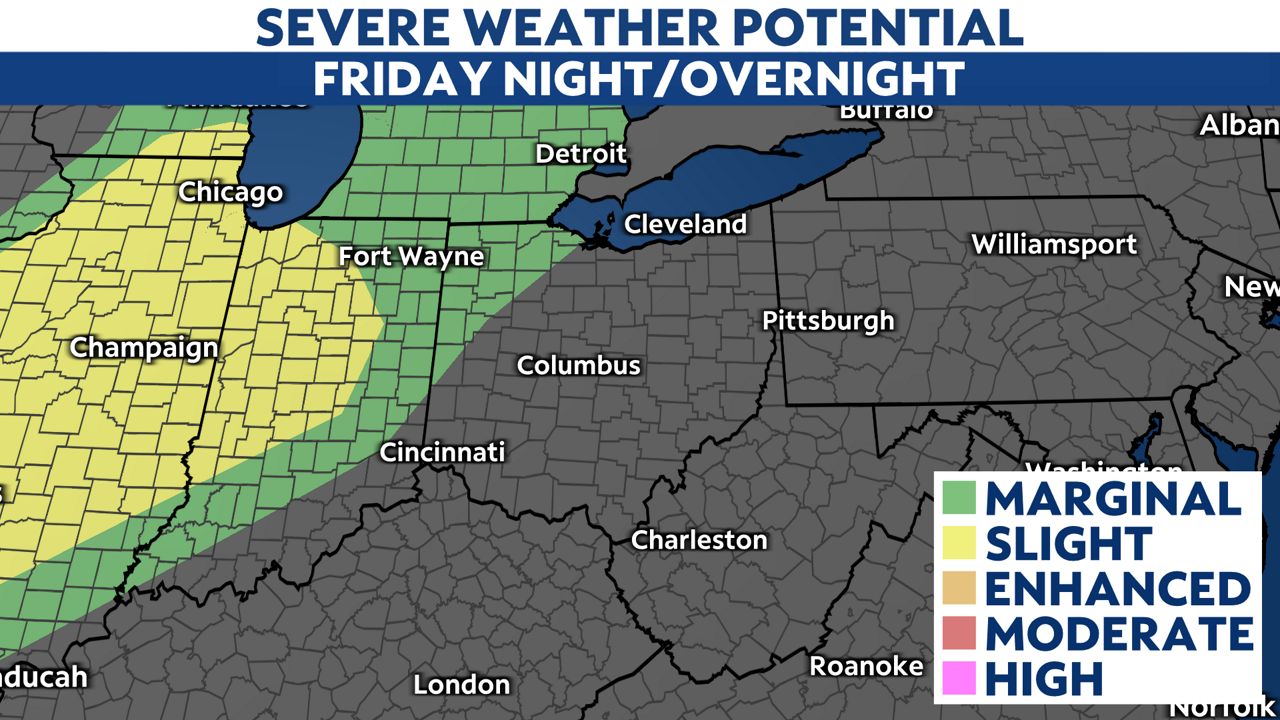
Severe weather looks unlikely but a few storms could approach severe limits with wind and hail mainly in northwest Ohio.
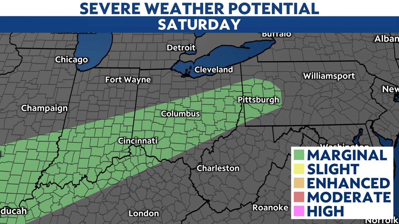
The low risk for severe weather moves southeast through mid-morning Saturday.
)
Even if these storms stay below severe limits, be prepared to move indoors with lightning and gusty downpours.
A few isolated severe storms are possible in the early afternoon before we change to scattered rain.
)
If you are going to watch the Columbus Crew in Cleveland against Inter Miami, bring the rain gear.
The match begins at 4:30 p.m., and we may see some scattered showers in that timeframe.
Rain chances are a lot less on Easter, but a brief shower cannot be ruled out.
)
Highs will be cooler and below normal especially in the north.
We do see more widespread rain on Monday, but temperatures will start to warm back up.
The trend for next week will be average or above average temperatures, so enjoy the mild extended forecast.