Sunday morning showers cleared early, giving a glimpse of sunshine across the Commonwealth. Although this will be short-lived, as Kentucky prepares to face another round of severe weather later on Sunday.
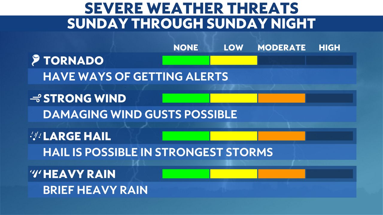
The Storm Prediction Center (SPC) blanketed Kentucky under an enhanced risk (level 3 out of 5) for severe weather again through this evening. Strong storms could produce damaging winds, hail, and potentially enough rainfall to lead to localized flooding.
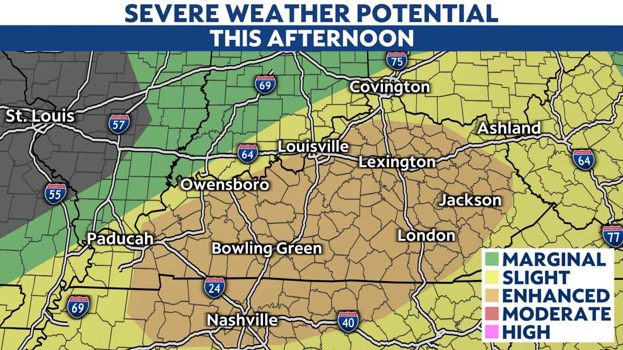
The risk for any tornado development is very low, but is still a consideration.
As the morning showers moved through and out of the area, clear skies will allow for temperatures to warm rather quickly. This creates more instability in the atmosphere- which, along with the significant moisture, will help fuel this next batch of strong storms.
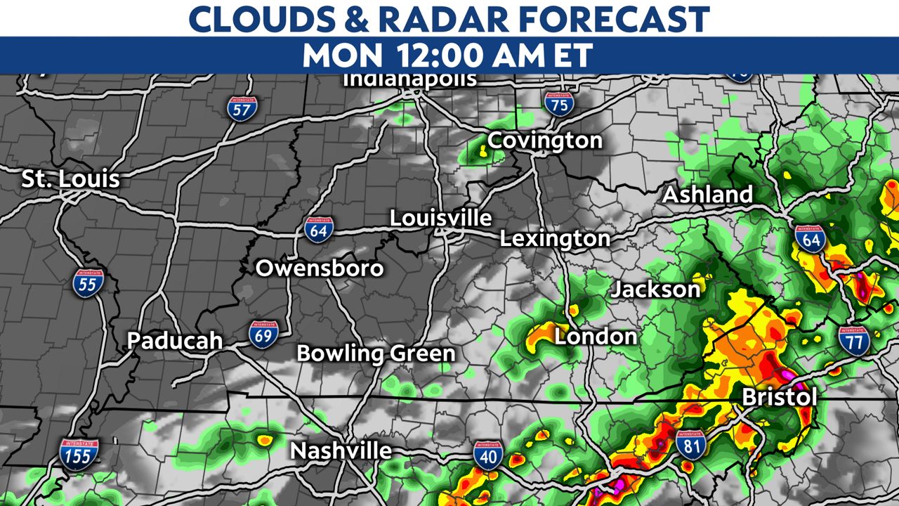
Recent runs of computer models show that the timing sets the storms to arrive on the western edge of Kentucky around 4:00 p.m. CT (5:00 p.m. ET).
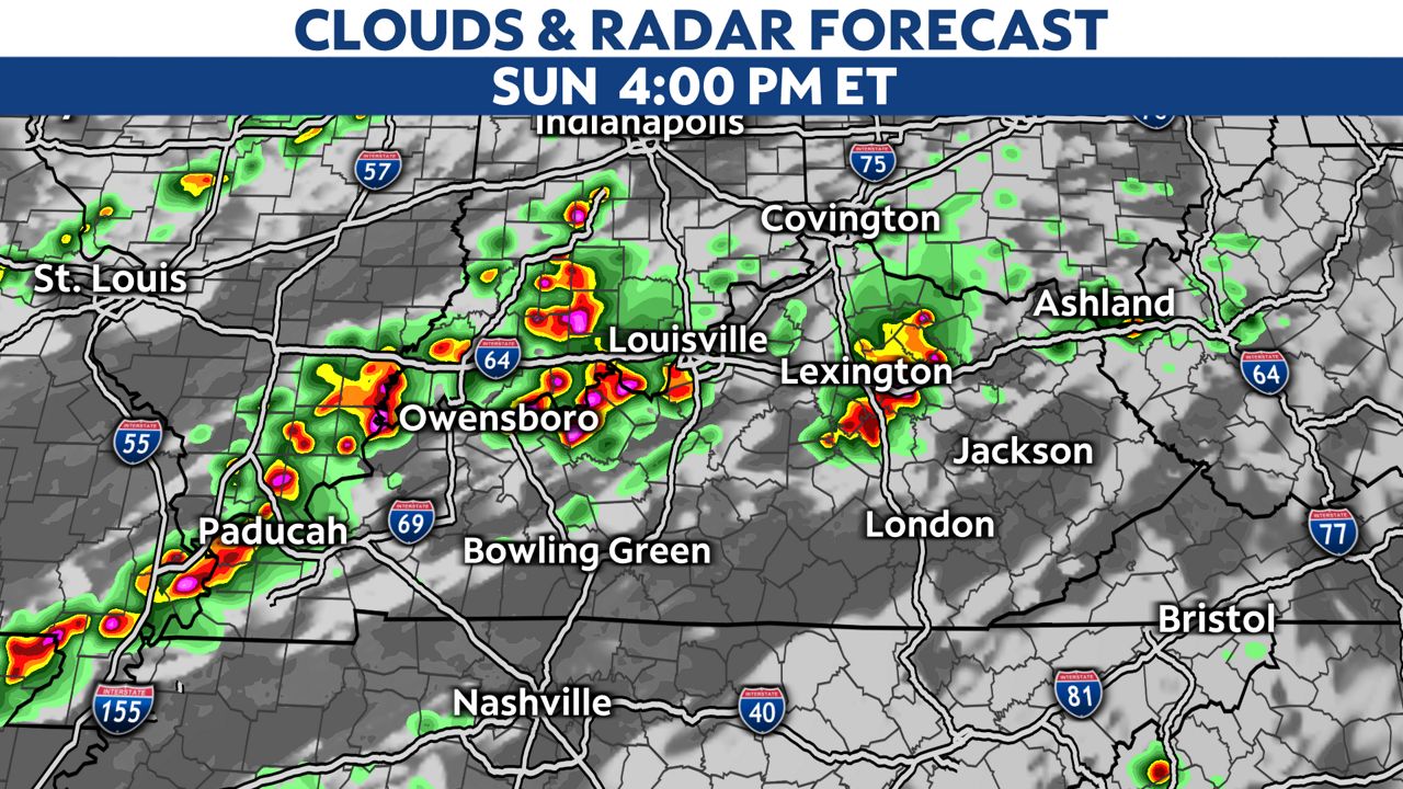
These will potentially be stronger near Southern Illinois, Southwest Indiana and Western Kentucky.
They will move to the east and should be out of the Bluegrass after midnight.
Stay weather aware and prepare ahead of time before severe storms arrive. Sign up for weather notifications to receive the latest weather updates, and keep up with this article for the latest details on this event.
Our team of meteorologists dives deep into the science of weather and breaks down timely weather data and information. To view more weather and climate stories, check out our weather blogs section.