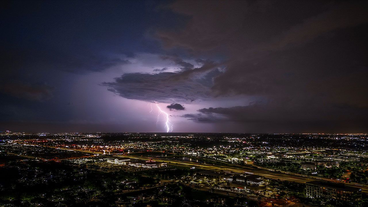
Along with steamy temperatures and high dew points, strong to severe storms will likely impact the Commonwealth through Sunday night.
The line of showers that pressed through central Kentucky Sunday morning will continue moving out of the area by the early afternoon hours. These storms had significant lightning, rainfall and winds reaching between 30 and 40 miles an hour.
In fact, the National Weather Service (NWS) reported rainfall totals as much as 2.5 to 3 inches in central Kentucky.
Following this first round of storms, skies will clear, allowing temperatures to warm up even more by the afternoon. This, combined with an ideal amount of moisture in the atmosphere, will help fuel the second line of storms that are headed our way.
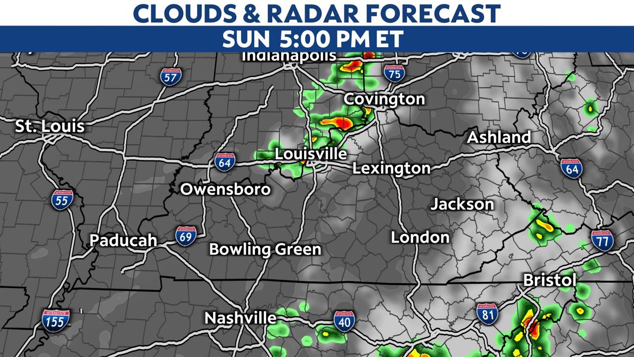
We can expect to start seeing this second line of storms move in from the southern edge of Indiana after 5 p.m. Strong to severe storms will proceed to march south and east across Kentucky through the evening hours into the overnight.
Much of the state is under a slight to enhanced risk (level 2-3 of 5) for severe weather through Sunday night.
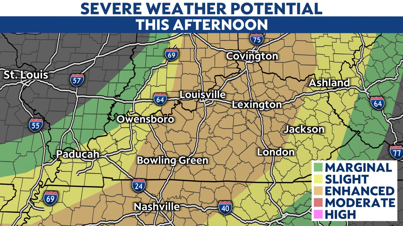
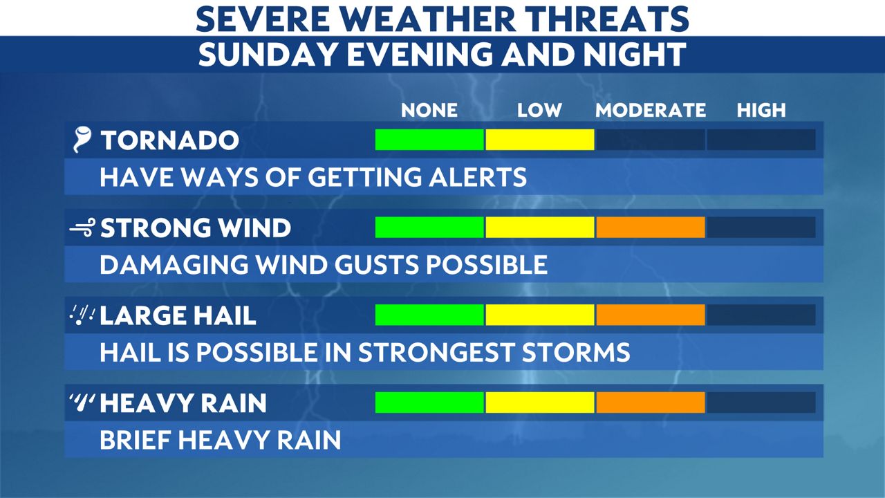
All modes of severe weather are possible, with storms capable of producing damaging winds, frequent lightning, and locally heavy downpours.
Yet, northwestern parts of the state, including the city of Louisville, face the biggest threat for seeing tornadoes or large hail.
Severe Thunderstorm Watches could be issued later this afternoon in anticipation of the line of storms, but the timing of this will depend on how quickly the storms intensify.
It is important to have a weather safety plan ready to put into place as these storms begin moving into the area. If the storms do fire up, they will do so quickly and become rapidly dangerous as they develop.
Our weather team will continue monitoring these conditions and work to keep you informed as the afternoon progresses.

Stay weather aware and prepare ahead of time before severe storms arrive. Sign up for weather notifications to receive the latest weather updates, and keep up with this article for the latest details on this event.
Our team of meteorologists dives deep into the science of weather and breaks down timely weather data and information. To view more weather and climate stories, check out our weather blogs section.