


The clear skies and pleasant temperatures we had across the Commonwealth on Saturday are giving way to stormy conditions on Sunday afternoon.
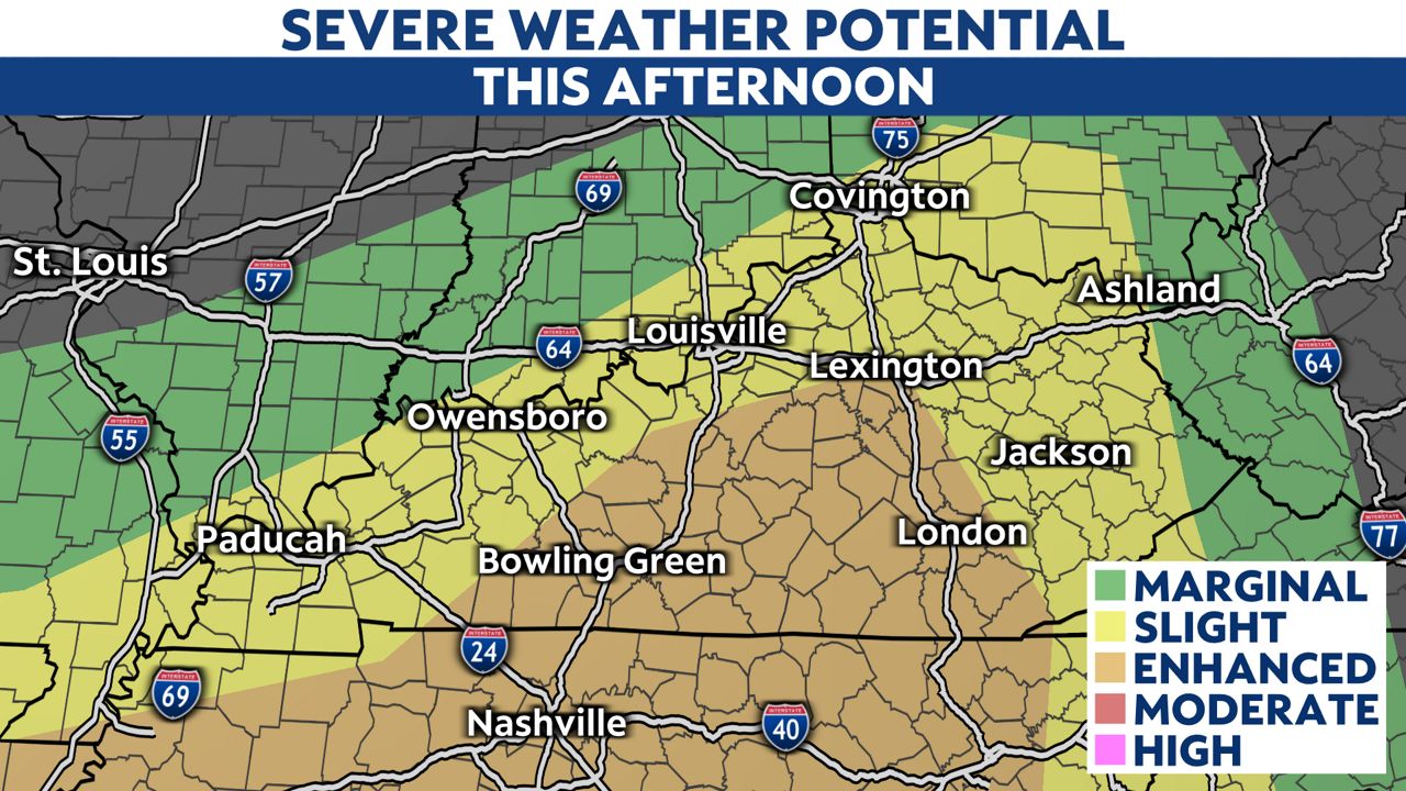
The Storm Prediction Center (SPC) has put most of the state under a slight risk (level 2 of 5) for severe weather. A large portion of central and southern Kentucky has been included under an enhanced risk (level 3 of 5).
With the threat of heavy rainfall, there is a possibility of flash flooding in drier areas due to the lack of significant precipitation in recent weeks.
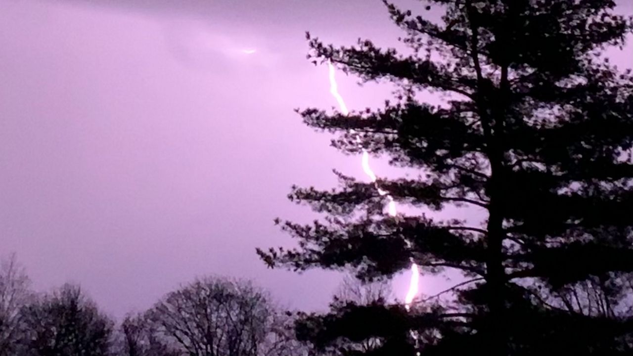
Although lightning remains the biggest concern, damaging winds and large hail also pose a significant threat.
The threat of a tornado is extremely low but does exist, especially for areas under the enhanced risk.
Throughout the morning hours on Saturday, much of the eastern Kentucky will see rainfall, with some of it encompassing heavy downpours. Lighting has already been observed within this precipitation.
This rain will continue to move east out of the area, giving way to some clearing during the early afternoon hours.
If the clouds give way to clear skies, albeit temporarily, this could create additional warming in the atmosphere and add to the energy of the advancing thunderstorms. This could be the catalyst for having more severe thunderstorms and severe weather conditions.

During the afternoon, an approaching cold front will move across Kentucky, forcing the storms ahead of it.
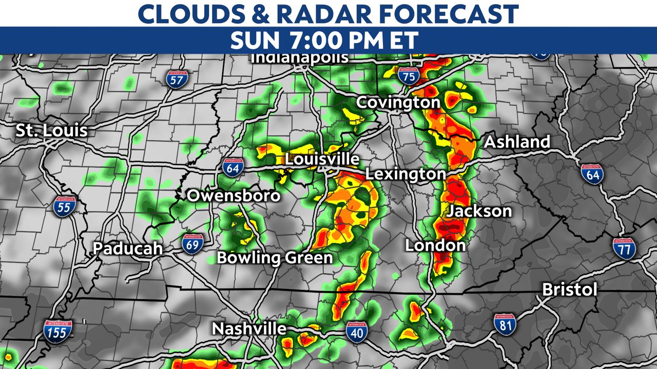
The western edges of the state will see the frontal boundary clear the region later this evening, while eastern Kentucky could still see rainfall into early Monday morning.
After the cold front moves out of Kentucky, we will be left with cloud cover to start our Monday. High temperatures will only reach in the low to mid-70s.
Our team of meteorologists dives deep into the science of weather and breaks down timely weather data and information. To view more weather and climate stories, check out our weather blogs section.