


New York City will see high winds and a big drop in temperatures across the rest of Friday after a pre-holiday winter storm stalled travelers at all of New York City’s airports on Thursday and left hundreds of residents in the dark through Friday morning.
The National Weather Service has issued a Wind Advisory for the city and other nearby counties from Thursday night through Friday evening as the winter storm passes through.
Precipitation was the main weather story Thursday night into Friday morning, as flooding was reported in several boroughs amid the rainfall.
Shortly after 12:30 p.m. Friday, the National Weather Service issued a severe thunderstorm warning for Queens County, Kings County and Nassau County. The warning has since expired. The storm produced hail in parts of Queens.
Snow and hail were also spotted in parts of the five boroughs briefly Friday afternoon.
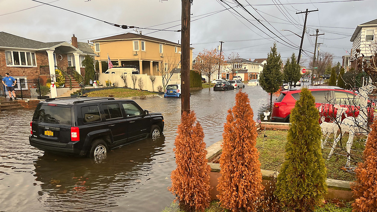
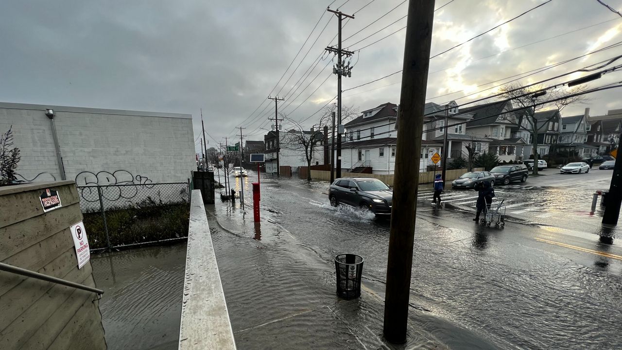
Widespread Flooding
Staten Island Ferry service was temporarily suspended due to extreme weather and high tide, according to the Department of Transportation. However, a spokesperson confirmed to NY1 around 9 a.m. that the ferry would be operating on a modified schedule, running every 20 minutes through the morning rush hour and then returning to every 30 minutes. The spokesperson noted service may continue to change throughout the day.
Meanwhile, widespread flooding was reported in parts of southern Queens and Brooklyn.
As parts of city began to experienced extreme weather and flooding, the MTA announced that all Queens express, limited, local and select bus service was delayed in both directions. Some routes, including the Q53-SBS, were completely suspended in areas due to roadway flooding.
"The biggest challenge with this current storm is that this storm will present multiple hazards in New York,” the city's emergency management commissioner, Zach Iscol, said at a briefing Thursday. “We’re asking New Yorkers to take all the precautions necessary ahead of the holiday weekend.”
The city also issued a travel advisory through Friday morning and all New Yorkers were encouraged to stay off the road and use mass transit if necessary.
Open streets and outdoor dining was suspended through 8 p.m. Friday, according to the city’s Department of Transportation deputy commission Leon Heyward, who oversees sidewalk and inspection management.
Travel Delays
The heavy rain and gusty winds caused hundreds of flight delays and cancellations at both John F. Kennedy International Airport and LaGuardia Airport into Friday morning.
According to the flight data tracking company FlightAware, over 400 flights had been canceled at both airports by noon Friday. At one point during the morning, LaGuardia had seen the most cancellations in the U.S.
Travelers to both airports are advised to confirm their flight status with their airlines before arriving at their terminals.
LaGuardia Airport also issued a warning early Thursday that travelers should give themselves additional travel time before their flight.
"We advise all New Yorkers to stay off the roads during this storm. If you absolutely must travel, mass transit may be your best bet, but you should check MTA service status before you leave home," said Heyward.
Power Outages
Meanwhile, the storm left hundreds of Con Edison customers in the dark Friday morning.
Con Edison’s power outage map showed at least 1,100 customers in the five boroughs were without power at 6 a.m. Friday morning, while hundreds more customers north of the city were also dealing with outages
Iscol said Thursday that ConEd had flown 600 additional workers to man 300 trucks across the five boroughs and the utility has asked customers to report all outages.
Looking Ahead
Weather conditions in the five boroughs were the worst between 9 p.m. Thursday and 2 a.m. Friday, with the city seeing the heaviest rain.
Friday afternoon and evening will bring a sudden drop in temperatures. With the rain finished, arctic air is rushing in. Temperatures will be cut in half within a few hours — dropping by up to 30 degrees, into the 20s by 6 p.m. — making flash freezing possible. Watch for scattered icy spots.
In anticipation of the storm, the Department of Sanitation on Thursday issued a “Winter Operations Advisory” for Friday, Dec. 23, beginning at 8 a.m., signaling snow plowing is not likely.
Instead, the DSNY is filling salt spreaders and smaller equipment in anticipation of sleet and ice.
“DSNY will be aggressively salting the streets and treating bike lanes to prevent ice accretion on one of the busiest travel days of the year,” the agency said in a statement. “New Yorkers can expect a ‘white Christmas’ of salt, rather than snow.”
The department will be treating bike lanes for the first time during an icy event, as they do when it snows, sanitation commissioner Jessica Tisch said at the briefing. She expects her agency will use up to 20 million pounds of rock salt in the coming days.
"We do want anyone who can stay home or take public transit to do so," Tisch said.
Pointing to high staffing levels, Tisch said the sanitation department will make their regular trash collections without delays.
Christmas Eve will feature a perfect winter forecast — besides the snow — with bright skies and highs in the mid-20s, though the feels-like readings will be in the single digits at times.
Christmas will also be sunny and cold, with highs in the 20s for a second day in a row. It will be the coldest Christmas since 2000.