The way November has played out so far in the Capital Region has undoubtedly been unexpected, at least weather-wise.
It seemed like towards the end of October, we were starting to head in the direction that we typically expect: A colder November with more winter weather. It was looking to be the case at first, with a cold start to the month, but it certainly did not stay that way.
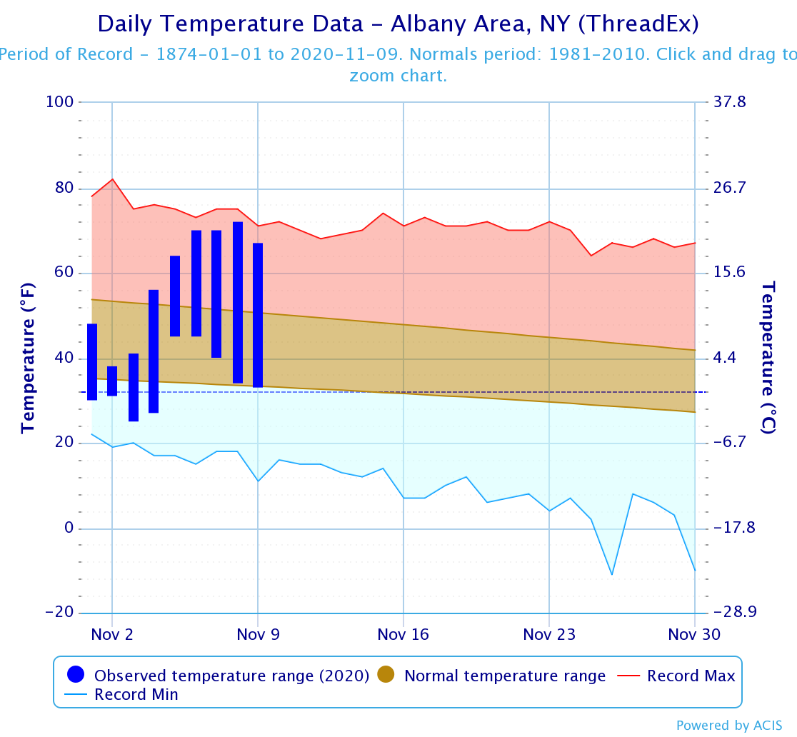
Using the city of Albany as a focal point, we first reflect on the start of the month. We were under a colder pattern, and temperatures for the first three days of the month fell below average.
November 1st, 2nd and 3rd fell six, 15, and 12 degrees below average, respectively.
The coldest day of the month so far was on November 2nd, with a high of 38 and a low of 31. The average high for November 2nd is 53 degrees, and the average low is 35.
To put into perspective how cold that day was, the high of 38 was 15 degrees colder than average, but only only three degrees warmer than the average low.
Less stunning was the low of 31 falling four degrees shy of the average.
As a strong ridge pattern in the upper levels of the atmosphere developed last week, we made a turn into the opposite direction. November 4th was the closest Albany got to a seasonable day, with a high temperature of 56 running three degrees above the average high of 53.
After that, temperatures skyrocketed.
Since November 4th, we have seen above-average temperatures on a daily basis. November 8th has been the warmest day of the month so far with a high of 72 and a low of 34.
The average high for November 8th is 51 degrees, while the average low is 34. Interestingly enough, that low of 34 matched the average low for the day.
Conversely, that high of 72 degrees ran 21 degrees above average, and three degrees shy of the record high of 75 set back in 1975. Albany found a 38-degree range in temperature that day, which has been the largest so far for the month.
While no temperature records in Albany have been broken yet, many records across New York State have been shattered. This includes Poughkeepsie, which saw three days in a row of record high temperatures between November 7th and 9th.
November 9th was the hottest day, with a record of 78 degrees. That’s 23 degrees above the average high of 55, and two degrees shy of 80 - in November!

It’s projected that temperatures will drop through the rest of the week. This coming Saturday may be the first day we run around average temperature-wise, as we potentially don’t reach 50.
The average high this coming Saturday is 49 in Albany. That may not last, though.
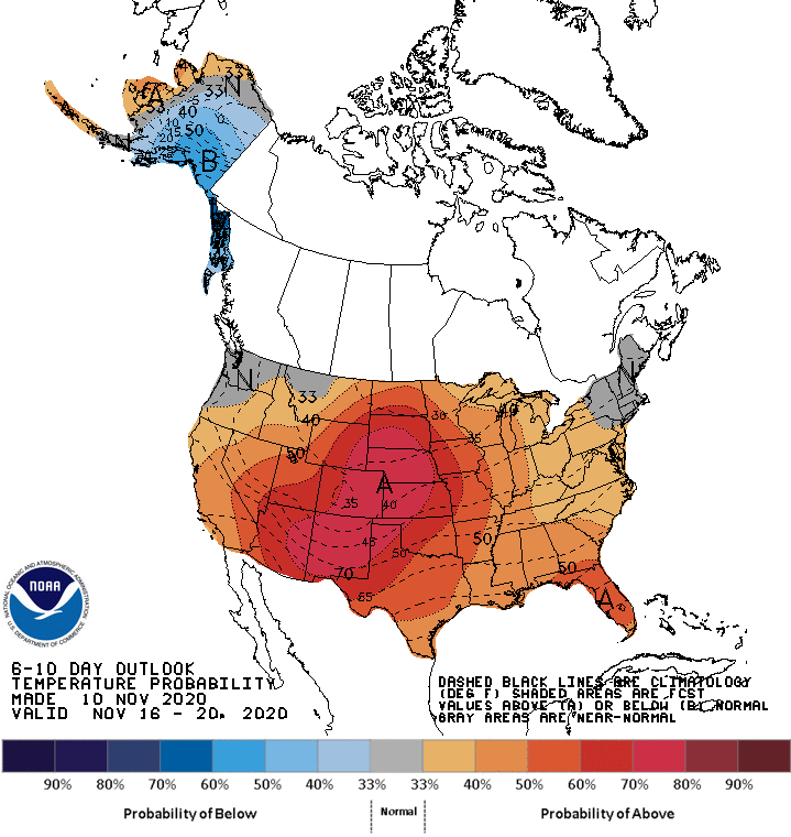
The Climate Prediction Center has issued their latest 6-10 day outlook, predicting near-average temperatures between November 16th to November 20th, though warm weather may soon make a comeback.
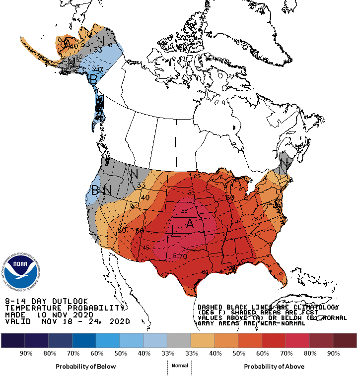
The 8-14 day outlook between November 18th and 24th suggests there is a 40% chance of above-average temperatures returning to the Capital Region.


This isn’t set in stone, but if this pans out, we may find ourselves with a November featuring more days being recorded as warmer than normal. As always, we’ll keep a close eye on how the coming weeks wind up.
In the meantime, hopefully you’ve had a chance to enjoy this abnormally warm and sunny week of November!


