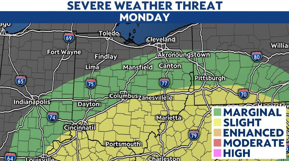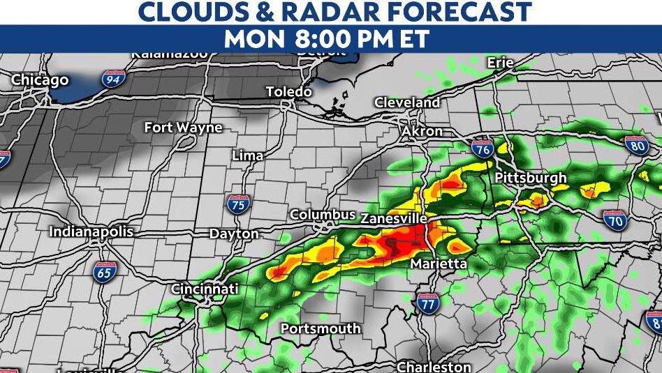
OHIO — A cold front moving through late Monday will produce a line of showers and thunderstorms, some of which will be severe.
Ahead of the front, temperatures will be very warm, in the 70s.
The highest threat will be areas along and southeast of I-71, starting around 4 p.m. and continuing through around midnight.
After the storms exit, cooler air returns Tuesday with highs back in the 40s north and 50s south.
)