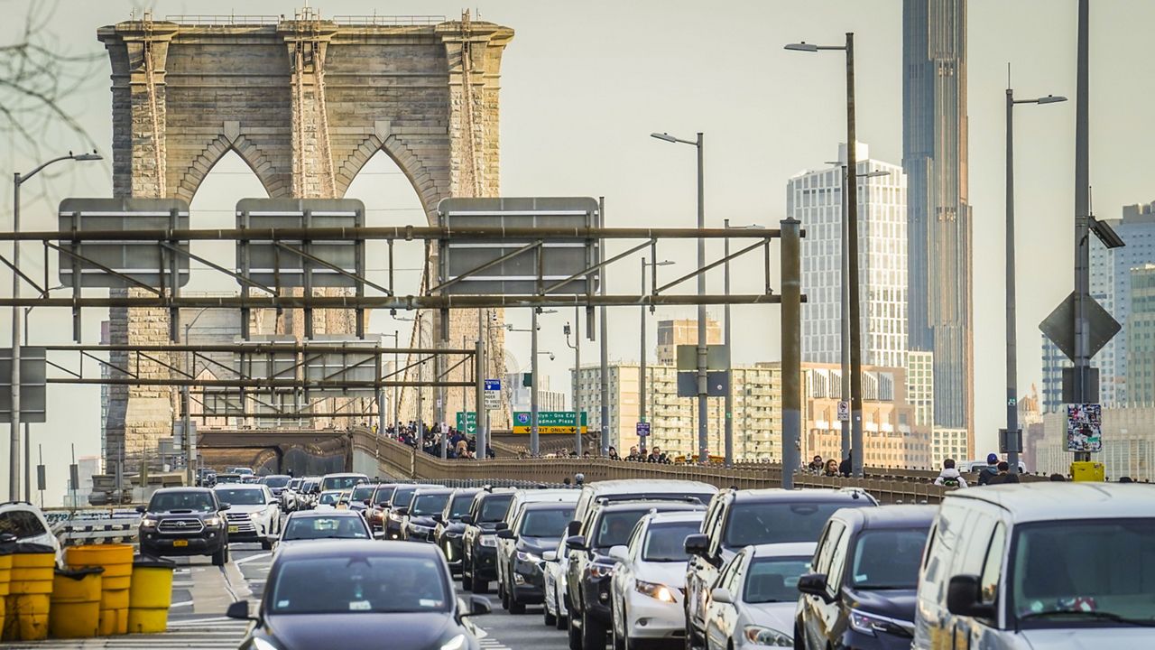
The problematic portion of the Brooklyn-Queens Expressway stretches from Sand Street to Atlantic Avenue.
Not only is it literally falling apart, but it also has been the center of a contentious debate for the community and for drivers.
When the triple cantilever was built decades ago, it was meant to minimize disruption to the surrounding neighborhood.
But over the years as the area has become more developed, residents say it has done the exact opposite.
Many community members describe it as intrusive, limiting access to Brooklyn Bridge Park and the waterfront.
“There are two access points, one over here and one down there probably like a half a mile a part,” pointed out Avril Do, a Brooklyn Heights resident. “If there was more access, people would be more inclined to come down here and go explore the promenade as well.”
Developed with that feedback, the city’s Department of Transportation officials recently unveiled these three new design concepts.
Each design would repair the roadway and better connect Brooklyn Heights Promenade to the waterfront park.
Two of the designs, titled “The Terraces” and “The Look Out” would do so with a partial replacement of the cantilever.
The third design, referred to as “The Stoop,” would require a full replacement of the highway structure.
“I mean it would be nice to see them have an underground passage and I drive myself on the lanes, and it is terrible, but I don’t think it is going to happen,” said Brooklyn Heights resident Gordon Ng, who walks his dog in the park regularly.
There are many steps before a design is finalized, but DOT officials said the community would be involved through the entire process.
The three concepts will all enter a federal environmental review process and the final design won’t be known until the end of that process, which is expected to take two years.
“We’re aggressively moving ahead with the environmental review process so we can get to actual construction and make a real difference in our area,” explained Deputy Mayor of Operations Meera Joshi.
This month, the DOT will begin a traffic study to see if the final design should include two or three lanes.
Projected timelines on construction of the final design are set to begin in 2027.
_PKG_DOT_BQE_Improvements_CG_131225588_368)