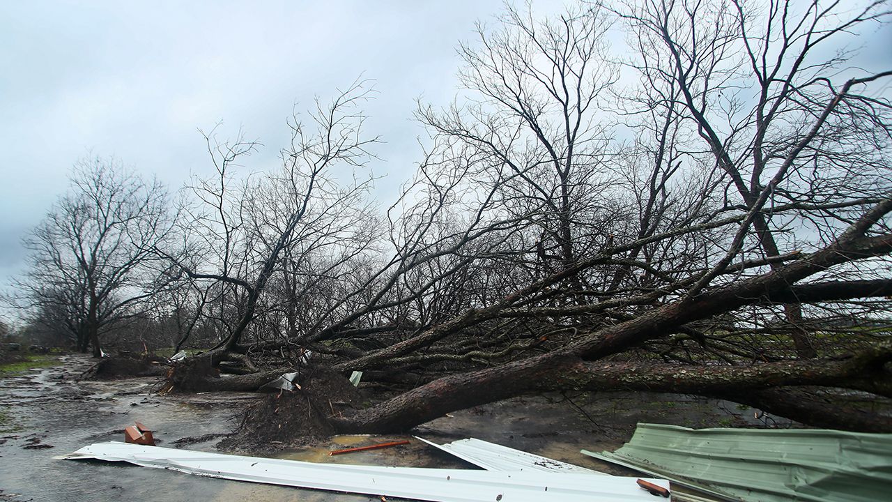
A potent storm system continues to move through the commonwealth this weekend.
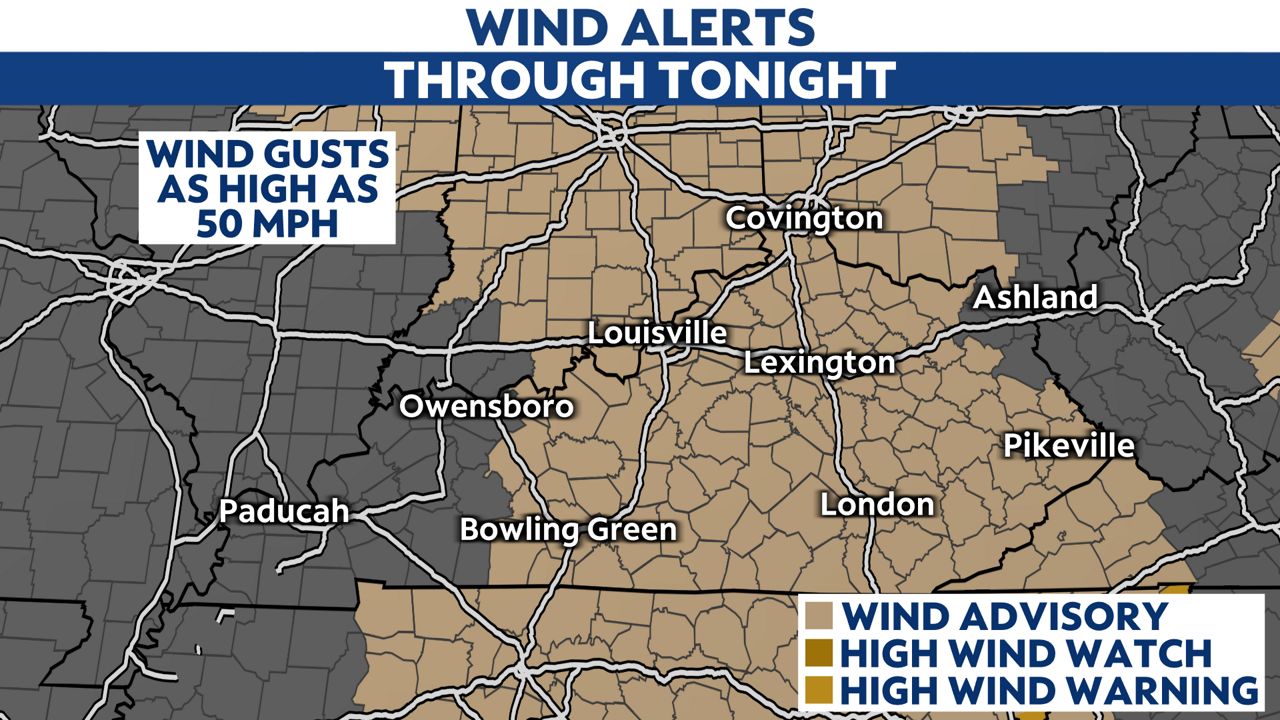
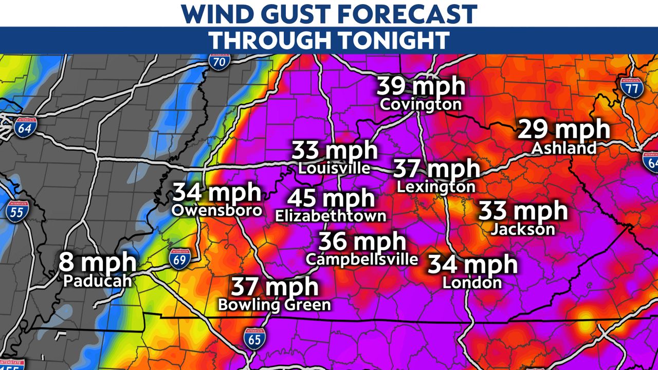
We have a Wind Advisory with wind gusts up to 50 mph until very early Sunday morning
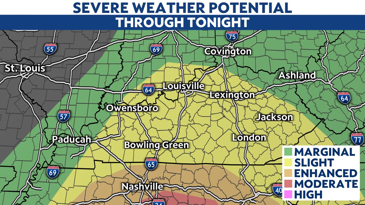
Strong storms will continue into tonight. The main threats will be damaging straight-line winds and potentially a few tornadoes. Here is the risk area for tonight.
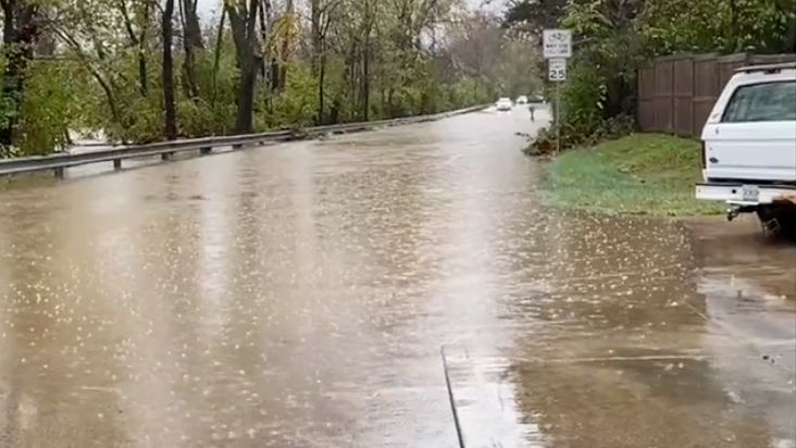
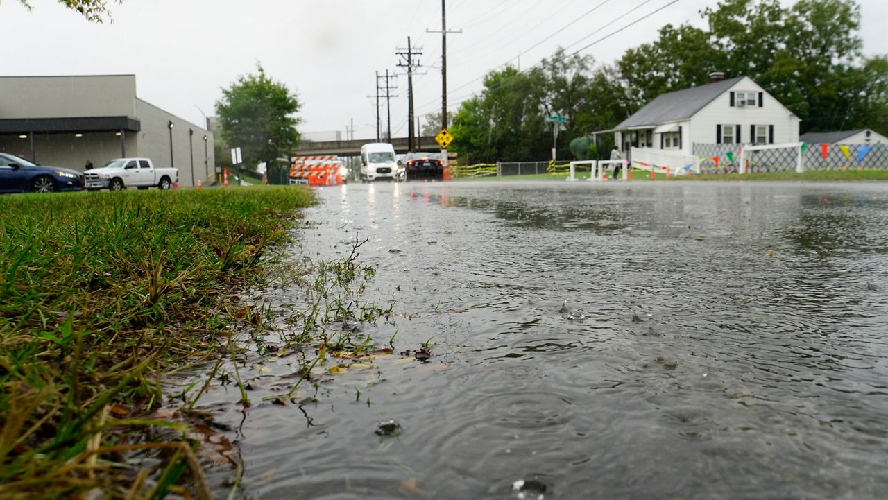
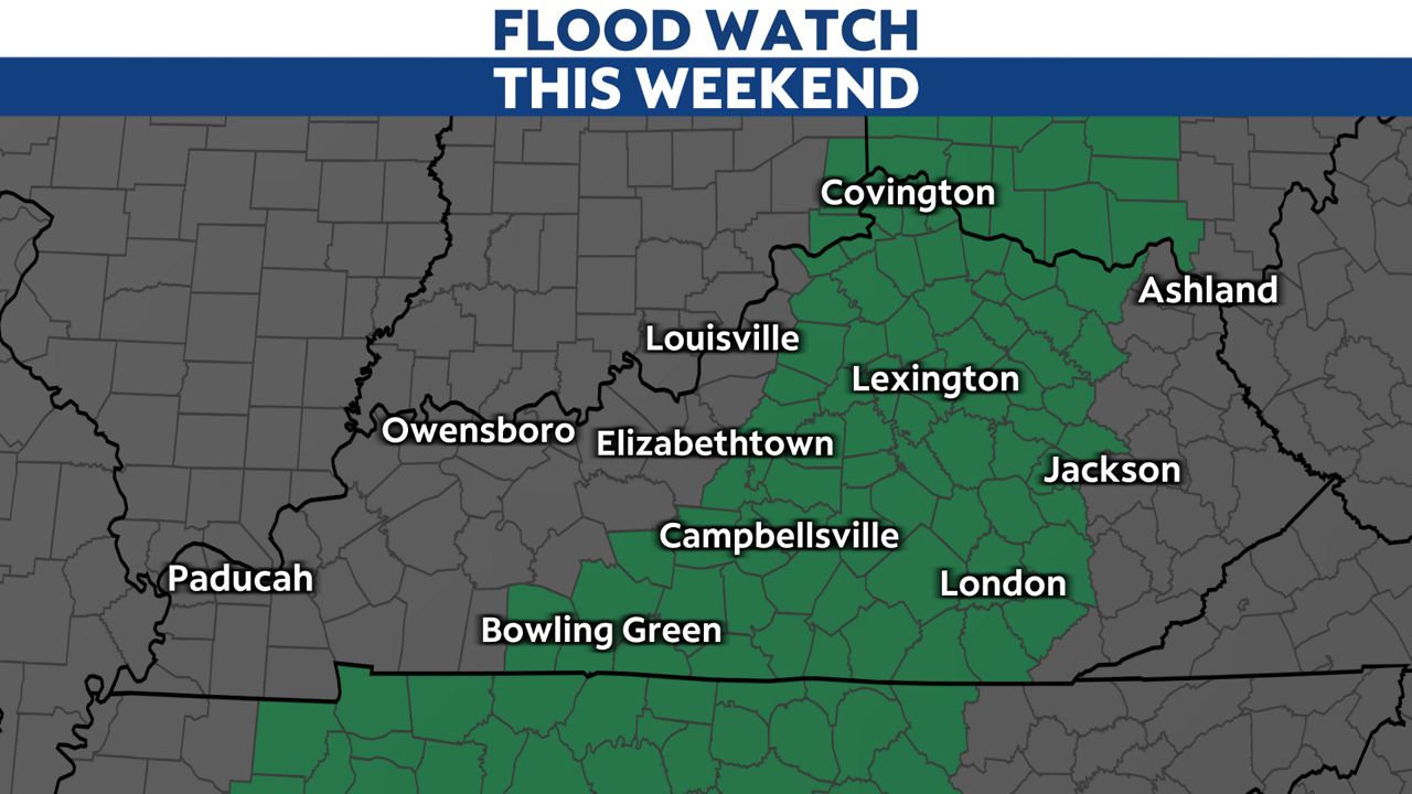
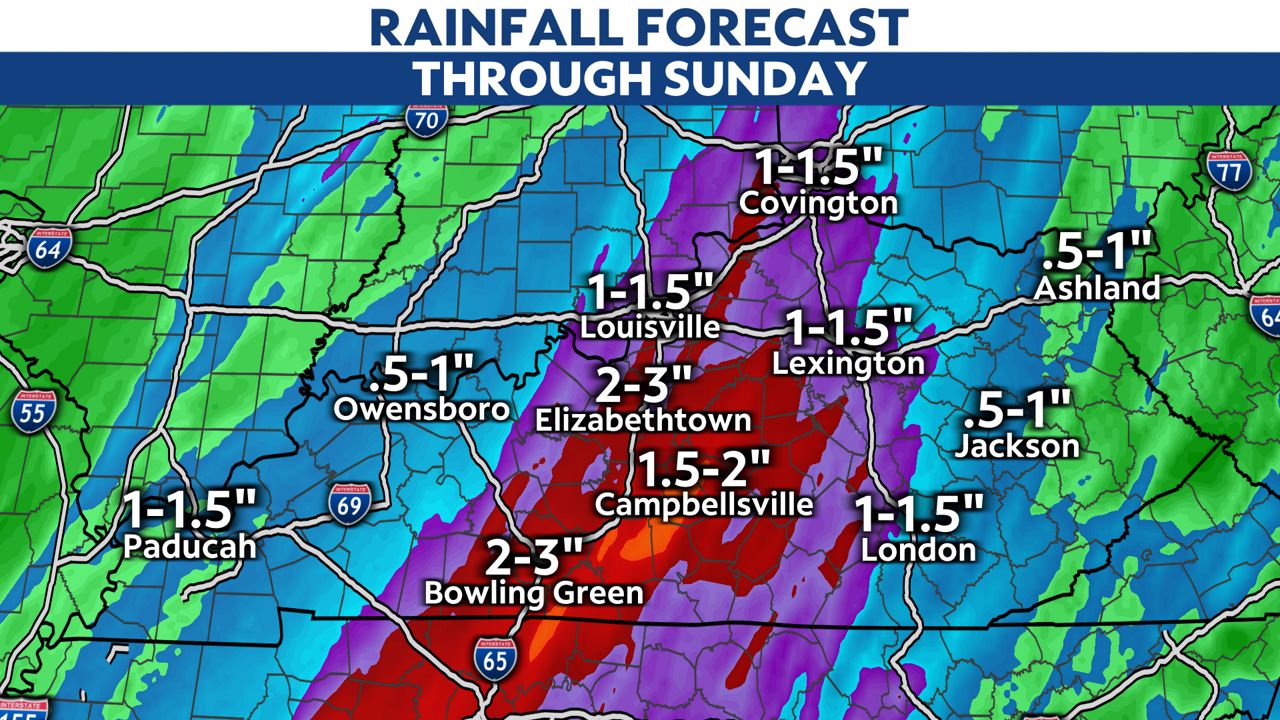
Central and eastern Kentucky are likely to see the potential for flooding when 1 to 2 inches of rain could fall across the area. For that reason, a flood watch has been issued for those parts of the commonwealth.
Our team of meteorologists dives deep into the science of weather and breaks down timely weather data and information. To view more weather and climate stories, check out our weather blogs section.